Port-Louis, « Ville où il fait bon vivre », « Petite cité de caractère » et « Cité maritime »
Un patrimoine exceptionnel avec 32 monuments classés, inscrits ou répertoriés au titre des Monuments Historiques.
Monuments
et
patrimoine
Retrouvez la liste des 32 monuments historiques
Patrimoine maritime et littoral – Réhabilitation du bâti et médiations innovantes
La région Bretagne met à l’honneur la thématique du patrimoine maritime et littoral. Ci-dessous une vidéo de 3 minutes pour une exploration du patrimoine maritime breton.
La Citadelle – Ar Sitadelle – The Citadel
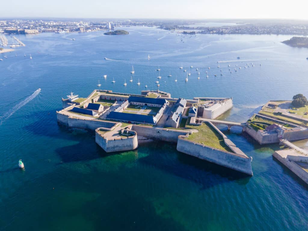
La citadelle de Port-Louis, édifiée à partir de 1591 sous la conduite de Cristobal de Rojas est située sur une pointe rocheuse à l’entrée de la rade de Lorient. Maintes fois remaniée pour aboutir à l’actuel plan rectangulaire bastionné aux angles et aux côtés, la Citadelle abrite aujourd’hui le musée de la Compagnie des Indes et le musée national de la Marine.
Sitadell Porzh-Loeiz, savet adal 1591 edan renerezh Cristobal de Rojas, a zo àr ur beg roc’hek e genoù morlenn an Oriant. Adkempennet e oa bet meur a wezh, betek donet d’ar plan hirgarrezek a-vremañ, get bastionoù er c’hornioù hag àr ar c’hostezioù ; hiziv e vez kavet er Sitadell mirdi Kompagnunezh an Indez ha mirdi broadel ar Moraerezh.
The citadel of Port-Louis, built from 1591 onwards under the direction of Cristóbal de Rojas, stands on a rocky headland at the entrance to the Lorient roadstead. Altered many times before reaching its present rectangular plan, with bastions at the corners and along the sides, the Citadel today houses the Musée de la Compagnie des Indes (East India Company Museum) and the Musée national de la Marine (National Maritime Museum).
L’enceinte Urbaine (les remparts) – Ar vagoer-dro (ar ramparzhioù) – The town walls (the ramparts)
En langue bretonne – Er brezhoneg
1616 – Loeiz XIII a ziviz lakaat BLAÑVEZH da vout ur gêr roueel. PORZH-LOEIZ a vo hec’h anv (1618) ha kreñvaet e vo.
1649 – 1653 – Dug LA MEILLERAYE a laka sevel ar vagoer-dro.
1840 – 1843 – Donaet eo fozellioù talbenn ar mor. Reizhet eo ar parapedoù.
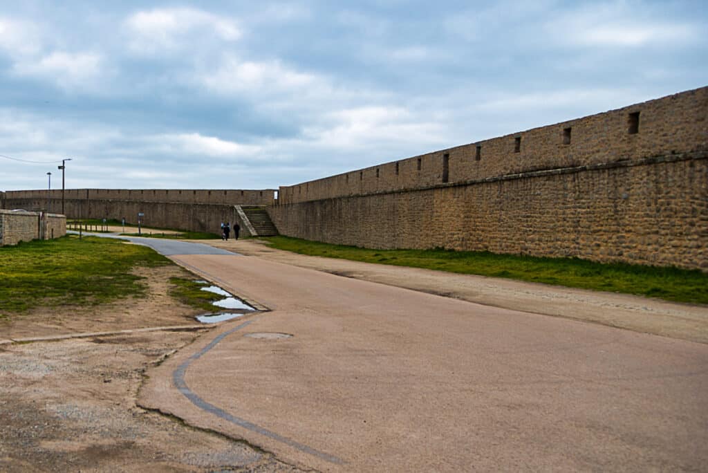
TALBENN AR MOR – DESKRIVADUR :
- Hirder : 1250 m.
- Tevder en diaz : 2 m.
- Uhelder etre 8 ha 11 m.
- Magoer mod kozh, get tourioù en he c’hornioù, anvet ivez bastionoù
- Àr he lein, ur parapet 2 m, toullet get toulloù-tenn, hag en e droad ur bazenn 1 m ledander a ra hent-tro ar gedourion.
- Rummet eo ar vagoer-dro evel Monumant Istorel abaoe an 12 a viz Mae 1933.
- 1616 – Louis XIII décide de faire de BLAVET une ville royale. Elle s’appellera PORT-LOUIS
(1618) et sera fortifiée. - 1649 – 1653 – Le Duc de la MEILLERAYE fait construire le mur d’enceinte.
- 1840 – 1843 – Approfondissement des fossés du front de mer.
Rectification des parapets.
FRONT DE MER – DESCRIPTIF :
- Longueur : 1250m.
- Épaisseur à la base : 2m.
- Hauteur variant de 8 à 11m.
- Mur à l’antique, flanqué de tours à ses brisures appelées aussi Bastions.
- Surmonté d’un parapet de 2m, percé d’embrasures, au pied duquel règne une banquette
de 1m de large formant le chemin de ronde.
Le mur d’enceinte est classé Monument Historique depuis le 12 mai 1933.
En anglais – In english
1616 – Louis XIII decides to make BLAVET a royal town. It will be named PORT-LOUIS (1618) and fortified.
1649 – 1653 – The Duke of LA MEILLERAYE has the town wall built.
1840 – 1843 – Deepening of the seafront moats. Straightening of the parapets.
SEAFRONT – DESCRIPTION :
- Length: 1,250 m.
- Thickness at the base: 2 m.
- Height varying from 8 to 11 m.
- Wall in the old style, flanked at its angles by towers, also called bastions.
- Topped by a 2 m parapet pierced with embrasures, at the foot of which runs a 1 m wide banquette forming the wall-walk.
- The town wall has been a listed Historic Monument since 12 May 1933.
La grande plage – An draezhenn vras – The main beach
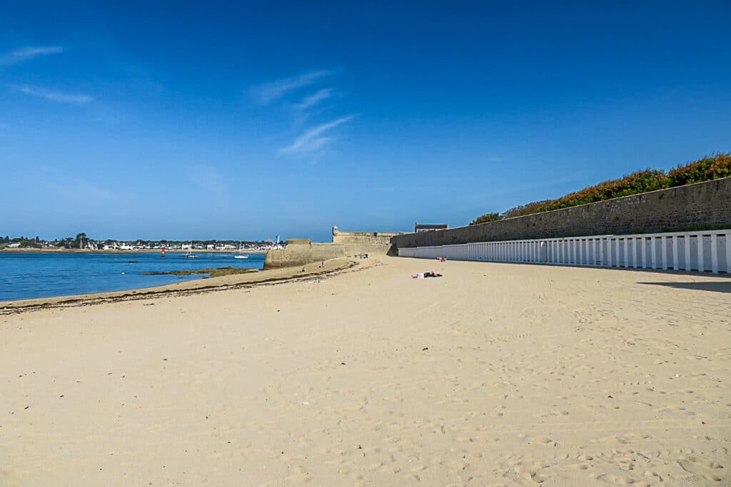
Appelée sous Louis XIII Les Grands Sables ou Le Grand Sablon.
Anvet e oa Ar Sableg Vras edan Loeiz XIII.
Known under Louis XIII as Les Grands Sables or Le Grand Sablon.
En langue bretonne – Er brezhoneg
- 1837 – Feurmet eo an dachenn d’ar Gumun get ar Ijinourezh Milourel.
- Savet zo un ti kouronkadennoù-mor edan gwarez ar Rouanez Marie-Amélie, pried Louis-Philippe.
- 1847 – Toullet eo dor an draezhenn.
- 1882-1888 – Savet zo ur preti e koad anvet Casino ha logelloù-traezh.
- 1922 – Kumun Porzh-Loeiz, dirummet he douaroù milourel, a bren an draezhenn get Melestradurezh an Domanioù. Adsavet eo ar « Casino » e mein. Distrujet eo bet ar savadur-se e-pad brezel 1939-1945.
- Bremañ e kaver àr an draezhenn ur post-sikour ha surentez, ar logelloù-traezh ha pretioù.
- 1837 – Location du terrain par la Commune auprès du Génie Militaire.
- Création d’un établissement de bains de mer sous le patronage de la Reine Marie-Amélie, épouse de Louis-Philippe.
- 1847 – Ouverture de la porte de la plage.
- 1882-1888 – Construction en bois d’un restaurant appelé Casino et de cabines de plage.
- 1922 – La commune de Port-Louis dont les terrains militaires ont été déclassés, acquiert la plage à l’Administration des Domaines. Reconstruction du « Casino » en dur. Ce bâtiment a été détruit au cours de la guerre de 1939-1945.
Actuellement, on trouve sur la plage un poste de secours et de sécurité, les cabines de plage et des restaurants.
En anglais – In english
- 1837 – The land is leased by the Town from the Military Engineers.
- A sea-bathing establishment is created under the patronage of Queen Marie-Amélie, wife of Louis-Philippe.
- 1847 – Opening of the beach gate.
- 1882-1888 – Construction in timber of a restaurant called the Casino, and of beach huts.
- 1922 – The town of Port-Louis, whose military land had been decommissioned, buys the beach from the State Property Office. The “Casino” is rebuilt in masonry. This building was destroyed during the 1939-1945 war.
Today the beach has a first-aid and safety post, beach huts and restaurants.
Les Pâtis – Ar Patisoù – The Pâtis
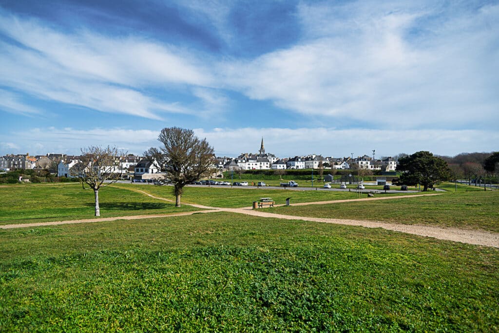
Ce site, vaste espace vert planté d’arbres, situé entre la Citadelle et la rue de la Brèche, a été inscrit à l’inventaire des Monuments Historiques le 23 septembre 1942.
Deux rues menant à la citadelle et à la plage, l’avenue du Fort de l’Aigle et la rue des Bains traversent les Pâtis qui comportent trois parties distinctes : les Glacis, l’Esplanade, les Poullo.
Ar lec’h-mañ, un dachenn c’hlas ledan plantet get gwez, etre ar Sitadell ha straed an Toullad, a zo bet enskrivet e renabl ar Monumantoù Istorel d’an 23 a viz Gwenholo 1942.
Div straed a gas d’ar sitadell ha d’an draezhenn, bali Kreñvlec’h an Erer ha straed ar Bains, a dreuz ar Patisoù, eh eus teir lodenn disheñvel enne : ar Rampelloù, ar Reper, ar Poulloù.
This site, a large green space planted with trees between the Citadel and Rue de la Brèche, was added to the register of Historic Monuments on 23 September 1942.
Two streets leading to the citadel and the beach, Avenue du Fort de l’Aigle and Rue des Bains, cross the Pâtis, which comprises three distinct parts: the Glacis, the Esplanade and the Poullo.
- À l’ouest, les GLACIS, bordant en pente le fossé de la Citadelle.
- 1636 et 1637 – Aménagés lors de l’édification de la demi-lune.
- 1945 – Découverte, dans les ruines d’un stand de tir, des dépouilles de 69 résistants fusillés par les nazis.
- 1960 – Construction du Mémorial sur le lieu de l’exécution. À proximité, petit monument en souvenir des déportés et résistants port-louisiens.
- L’ESPLANADE, de part et d’autre de l’avenue du Fort de l’Aigle, bordant la rue de la Brèche à l’est.
- 1756 – On y planta des arbres formant un bosquet appelé le Bois d’amour.
- Sous la Révolution, l’Esplanade devint le Champs de Mars.
- En 1838, on y aménagea des allées et des bancs de granit. L’Esplanade servait aux revues, aux exercices des troupes de terre et de mer, et aux fêtes foraines et bals champêtres.
- Début du XXe siècle, construction de l’Hôtel de la Plage, près de la rue de la Brèche. Il a été détruit lors de la Seconde Guerre mondiale. Aménagement d’un terrain de football qui a été conservé. Des terrains de tennis ont été remplacés par des installations sportives de loisir et des jeux d’enfants.
- LES POULLO, c’est-à-dire les mares.
Dans la partie déclive des Pâtis, de l’enceinte côté rade au nord à l’enceinte maritime au sud, se succédaient des mares qui s’emplissaient d’eau à marée haute. - 1695 – Le long de l’enceinte maritime, installation d’une batterie de marine, la Batterie des POULLO. Une corderie a également existé au pied du rempart.
- Sous l’Ancien Régime, côté rade, aménagement des mares en un petit port pour les chaloupes.
- 1735 – Construction de la porte de la Brèche, munie d’une herse, donnant accès au port. Elle est actuellement murée.
- 1748 – Construction d’un magasin d’artillerie près du port. Détruit par un incendie en 1948.
- 1906 – Sur une partie des Poullo remblayée sous Napoléon III, on créa un vélodrome, sur l’actuel emplacement réservé aux cirques.
- Dans les années 1970, une nouvelle porte est percée dans les remparts, à proximité de l’ancienne porte de la Brèche, et un mini-golf est aménagé à l’emplacement du port.
En langue bretonne – Er brezhoneg
- Er c’hornôg, ar Rampelloù, a-hed fozell ar Sitadell.
- 1636 ha 1637 – Kempennet pand eo bet savet an hanter-loar.
- 1945 – Kavet eo bet, e dismantroù ur stand-tenn, korfoù 69 rezistant fuzuilhet get an nazied.
- 1960 – Savet eo ar Memorial er lec’h ma oant bet lazhet. Tost dezhañ, ur monumant bihan e koun an deportidi hag ar rezistanted a Borzh-Loeiz.
- An Reper, a bep tu da vali Kreñvlec’h an Erer, a-hed straed an Toullad er reter.
- 1756 – Plantet zo gwez eno, a ra ur c’hoadig anvet Koad ar Garantez.
- E-pad an Dispac’h e ta ar Reper da vout « le Champ de Mars ».
- E 1838 eh eus bet kempennet alezioù ha bankoù greunvaen eno. Gweladegoù hag embregadennoù ar soudarded douar ha mor, foarioù-plijadur ha baloù a veze graet àr ar Reper.
- E penn-kentañ an XXvet kantved ema bet savet Leti an Draezhenn, tost da straed an Toullad. Distrujet e oa bet e-pad an Eil Brezel-bed. Kempennet zo bet un dachenn vell-droad, hag a zo bet miret. Tachennoù tennis a zo bet erlec’hiet get aveadurioù sport-dudi ha c’hoarioù evit ar vugale.
- AR POULLOÙ.
E devalenn ar Patisoù, etre ar vorlenn en norzh hag ar mor er su, e oa poulloù hag a veze leuniet get dour pa veze uhel ar mor. - 1695 – Ur strollad kanonioù, Bateri ar POULLOÙ. A zo staliet a-hed ar ramparzh doc’h tu ar mor. Ur gordennerezh a zo bet ivez e troad ar vagoer-greñv.
- Kempennet eo ar poulloù doc’h tu ar vorlenn, edan ar Renad Kozh, a-benn sevel ur porzhig evit ar chaloupoù.
- 1735 – Savet eo dor an Toullad, get ur gloued-diskenn, evit lakaat ar bagoù bihan da vonet er porzh. Stanket eo bremañ.
- 1748 – Savet zo ur magazin artilherezh tost d’ar porzh. Distrujet eo bet get un tan-gwall e 1948.
- 1906 – Àr ur lodenn ag ar Poulloù leuniet edan Napoleon III eh eus bet savet ur velodrom, er lec’h ma vez lakaet ar sirkoù bremañ.
- Er blezadoù 1970 eh eus bet toullet un nor nevez er ramparzh, tost da zor gozh an Toullad, hag ur mini-golf a zo bet kempennet er lec’h ma oa ar porzh.
En anglais – In english
- To the west, the GLACIS, sloping down along the Citadel moat.
- 1636 ha 1637 – Laid out when the demi-lune was built
- 1945 -Discovery, in the ruins of a shooting range, of the bodies of 69 Resistance fighters shot by the Nazis.
- 1960 – Construction of the Memorial on the site of the execution. Nearby, a small monument in memory of the deportees and Resistance fighters of Port-Louis.
- The ESPLANADE, on either side of Avenue du Fort de l’Aigle, bordering Rue de la Brèche to the east.
- 1756 – Trees were planted there, forming a grove called the Bois d’Amour (Lovers’ Wood).
- During the Revolution, the Esplanade became the Champ de Mars..
- In 1838, walks and granite benches were laid out. The Esplanade was used for parades, for drills by land and naval troops, and for funfairs and open-air dances.
- Early 20th century: construction of the Hôtel de la Plage, near Rue de la Brèche. It was destroyed during the Second World War. A football pitch was laid out and has been kept. Tennis courts have been replaced by leisure sports facilities and children’s playgrounds.
- THE POULLO, that is, the ponds.
In the sloping part of the Pâtis, from the wall on the roadstead side to the north to the sea wall to the south, lay a series of ponds that filled with water at high tide. - 1695 – A naval battery, the POULLO Battery, is installed along the sea wall. A rope-walk also once stood at the foot of the rampart.
- Under the Ancien Régime, on the roadstead side, the ponds are turned into a small harbour for longboats
- 1735 – Construction of the Brèche gate, fitted with a portcullis, giving access to the harbour. It is now walled up.
- 1748 – Construction of an artillery store near the harbour. Destroyed by fire in 1948.
- 1906 – On part of the Poullo, filled in under Napoleon III, a velodrome was built, on the site now reserved for circuses.
- In the 1970s, a new gate was cut through the ramparts near the old Brèche gate, and a mini-golf course was laid out on the site of the harbour.
La fontaine des Récollets – Feuntan ar Rekolezed – The Récollets fountain
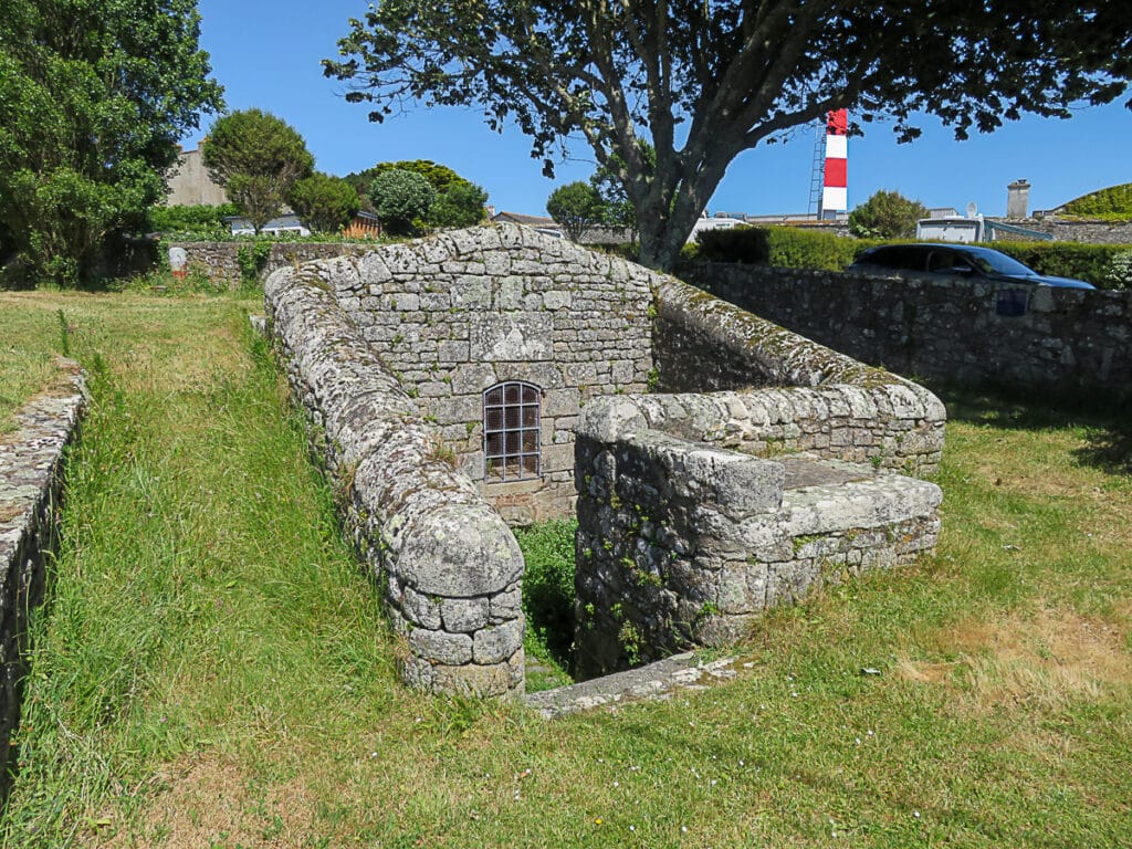
- Monuments de granit qui datent du XVIIe siècle.
- Fontaine pourvue d’un réservoir voûté en berceau qui alimentait l’ancien abreuvoir des POULLO, aménagé en lavoir en 1839, couvert d’une toiture en 1851.
Les vastes bassins sont bordés de pierres de taille.
- Monumantoù greunvaen ag ar XVIIvet kantved.
- Feuntan get ur mirlec’h dour get ur volz-fust, a gase dour da zourlec’h kozh ar POULLOÙ, kempennet da vout un douet e 1839, ha toet e 1851.
Mein-benerezh a vez lakaet tro-dro da boulloù an douet.
- Granite monuments dating from the 17th century
- A fountain with a barrel-vaulted reservoir that fed the old POULLO drinking trough, converted into a wash-house in 1839 and roofed over in 1851.
The large basins are edged with dressed stone.
Le jardin de la Muse – Jardin ar Muz – The muse garden
Situé au nord de l’ancien enclos des Récollets.
En norzh da glozenn gozh ar Rekolezed ema.
Located north of the former Récollets enclosure.
- 1713 – Création d’une Place d’Armes.
- 1770 – Le maire, Antoine BRÉMOND, fait disposer, sur les quatre côtés de la place, une double rangée d’ormeaux formant la Promenade de la Muse.
- 1786 – Construction d’un mur bas et des sièges en pierre bordant la rue de la Citadelle.
- 16 décembre 1792 – PORT-LOUIS devient PORT-LIBERTÉ.
Plantation solennelle du chêne de la Liberté.
La Place abrite, deux fois par semaine, le marché au lait. - 1879 – Les ormes, malades, sont remplacés par des tilleuls.
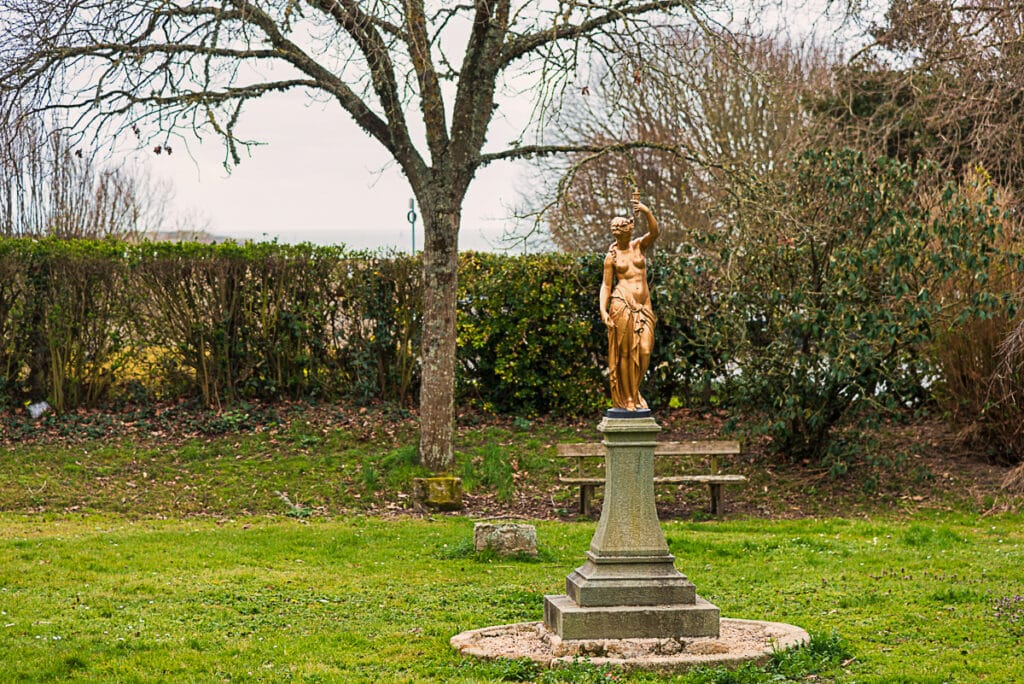
- 1880 – La Place d’Armes devient jardin public. Une statue éclaireuse, œuvre d’un sculpteur français renommé, Mathurin Moreau (1822-1912), y est installée.
Statue en fonte de fer provenant de la Fonderie du Val d’Osne.
Elle a perdu ses cinq luminaires. - 1945 – Plantation du chêne de la Libération.
- 1989 – Bicentenaire de la révolution française : Plantation de l’arbre de la Liberté.
En langue bretonne – Er brezhoneg
- 1713 – Savet zo ur Blasenn-Armoù.
- 1770 – Ar maer, Antoine BRÉMOND, a laka plantañ, àr pevar c’hostez ar blasenn, div renkad gwez-oulm a ra Pourmenadenn ar Muz.
- 1786 – Savet zo ur vur izel hag azezennoù mein a-hed straed ar Sitadell
- 16 a viz Kerzu 1792 – PORZH-LOEIZ a za da vout PORT-LIBERTÉ (Porzh-Frankiz).
Plantet eo get lid dervenn ar Frankiz.
Àr ar Blasenn e vez dalc’het, div wezh ar sizhun, marc’had ar laezh. - 1879 – Ar gwez-oulm, klañv, a zo erlec’hiet get gwez-tilh..
- 1880 – Plasenn an Armoù a za da vout ur jardrin foran. Un delwenn-c’houlaouiñ, oberenn ur c’hizeller gall brudet, Mathurin Moreau (1822-1912), a zo staliet enni.
Delwenn e houarn-teuz, daet a Deuzerezh ar Val d’Osne..
Kollet he deus he femp gouloù.. - 1945 – Plantet eo dervenn an Dieubidigezh.
- 1989 – Daou gant vlez an Dispac’h gall : plantet eo gwezenn ar Frankiz.
En anglais – In english
- 1713 – Creation of a Place d’Armes (parade ground).
- 1770 – The mayor, Antoine BRÉMOND, has a double row of elms planted on the four sides of the square, forming the Promenade de la Muse.
- 1786 – Construction of a low wall and stone seats along Rue de la Citadelle.
- 16 December 1792 – PORT-LOUIS becomes PORT-LIBERTÉ.
Solemn planting of the Liberty Oak.
Twice a week, the square hosts the milk market. - 1879 – The diseased elms are replaced by lime trees.
- 1880 – The Place d’Armes becomes a public garden. A lamp-bearing statue, the work of a renowned French sculptor, Mathurin Moreau (1822-1912), is installed there.
Cast-iron statue from the Val d’Osne foundry
It has lost its five lamps. - 1945 – Planting of the Liberation Oak
- 1989 – Bicentenary of the French Revolution: planting of the Liberty Tree.
La grande poudrière – Ar Boultrenneg Vras – The Great Powder Magazine
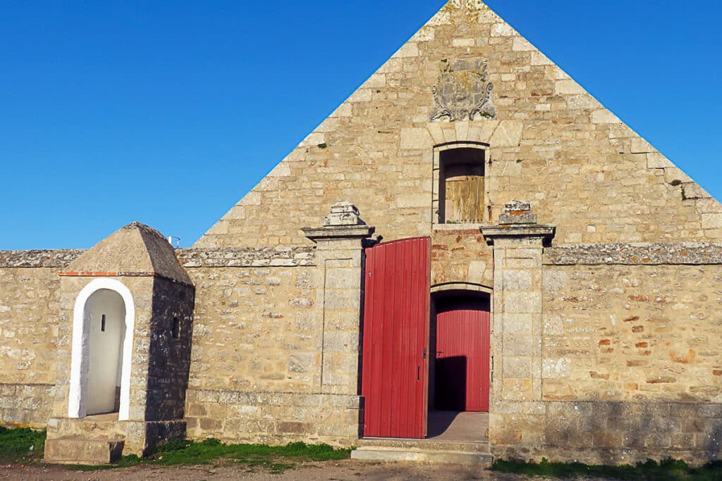
La Grande Poudrière abritait les poudres des batteries de terre et des vaisseaux qui faisaient escale au PORT-LOUIS.
1750 –1752 – Construction, sur les plans de l’ingénieur Le Royer de la Sauvagère, par Jacques ROBINET, entrepreneur des fortifications royales, et son associé le sieur GALLEN.
Er Boultrenneg Vras e veze dalc’het poultr ar baterioù douar ha poultr ar listri a rae un ehan e PORZH-LOEIZ.
1750 –1752 – Savet eo, diàr planioù an ijinour Le Royer de la Sauvagère, get Jacques ROBINET, embreger ar c’hreñvadurioù roueel, hag e genseurt an aotrou GALLEN.
The Great Powder Magazine held the gunpowder of the land batteries and of the ships calling at PORT-LOUIS.
1750 –1752 – Built, to the plans of the engineer Le Royer de la Sauvagère, by Jacques ROBINET, contractor for the royal fortifications, and his partner Mr GALLEN.
MATÉRIAUX
- Briques fabriquées à Quimperlé.
- Moellons extraits des carrières de Locmalo.
- Toit recouvert d’ardoises de Redon, remplacées par une couverture provisoire.
CARACTÉRISTIQUES
- Contenance 120 000 livres de poudre.
- Plafond en briques, voûté en berceau.
- Corniche extérieure en granit.
- Pignon sud : écusson aux armes de la maison Mazarine.
Ce blason a été martelé par les révolutionnaires, en 1792. - Après la Seconde Guerre mondiale, la Grande Poudrière a été louée comme atelier à un entrepreneur en bâtiment.
En langue bretonne – Er brezhoneg
DANVEZIOÙ
- Brikennoù graet e Kemperle.
- Mein-magoeriañ tennet a vengleuzioù Lokmaloù.
- Toenn goloet get mein-glas Redon, erlec’hiet get ur golo da c’hortoz.
PERZHIOÙ
- Dalc’had : 120 000 lur poultr..
- Plafoñs e brikennoù, get ur volz-fust.
- Rizenn diavaez e greunvaen.
- Pignon su : skoed get ardamezioù ti Mazarin
- Morzholet eo bet ar skoed-se get an dispac’herion, e 1792.
- Goude an Eil Brezel-bed ema bet feurmet ar Boultrenneg Vras evel stal-labour d’un embreger savadurioù
En anglais – In english
MATERIALS
- Bricks made in Quimperlé.
- Rubble stone quarried at Locmalo.
- Roof covered with Redon slates, since replaced by a temporary covering.
FEATURES
- Capacity : 120,000 pounds of gunpowder
- Brick ceiling, barrel-vaulted.
- Exterior granite cornice.
- South gable: escutcheon bearing the arms of the House of Mazarin.
- This coat of arms was hammered off by the revolutionaries in 1792.
- After the Second World War, the Great Powder Magazine was rented out as a workshop to a building contractor.
La porte de l’hôpital – Dor an Ospital – The hospital gate
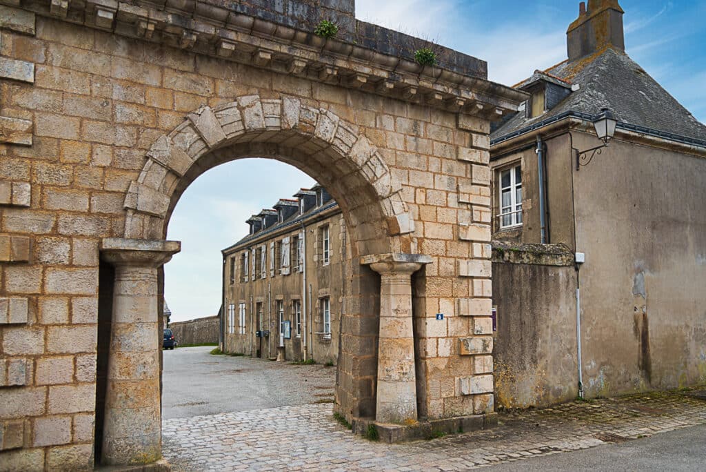
- 1653 – Transfert depuis LOCMIQUÉLIC de la communauté franciscaine, de Sainte-Catherine à PORT-LOUIS.
- 1656 – Construction du couvent des Récollets et de sa chapelle dédiée à saint François.
- 1675 – Installation des religieux dans le couvent.
- 1792 – Lors de la Révolution, les moines sont expulsés du couvent et le mobilier vendu aux enchères en 1793.
- 1795 – Un hôpital maritime s’installe dans les locaux désaffectés du couvent des Récollets.
- 1806 – Construction de la Porte de l’Hôpital avec son portail et ses deux colonnes trapues.
- 1936 – Fermeture de l’Hôpital maritime au profit de celui de Lorient.
- 1937-1939- Accueil des réfugiés espagnols dans l’ancien hôpital de la Marine.
- 1939 – Création de l’École des Transmissions Maritimes dans l’ex-hôpital.
- 1940 – Occupation des locaux par les troupes allemandes et construction d’un bunker.
- 16 mars 1945 – Destruction des bâtiments conventuels par un incendie.
- 1953 et 1971- Les ruines ont été progressivement rasées.
En langue bretonne – Er brezhoneg
- 1653 – Kumuniezh ar Frañsiskaned a zo dilec’hiet a Santez-Katelin, e LOKMIKAELIG, da BORZH-LOEIZ.
- 1656 – Savet eo kouvant ar Rekolezed hag e chapel gouestlet da sant Frañsez.
- 1675 – Ar venec’h a za da chom er c’houvant.
- 1792 – E-pad an Dispac’h ema kaset ar venec’h kuit ag ar c’houvant, ha gwerzhet eo ar gloestraj doc’h ar c’hresk e 1793
- 1795 – Un ospital-mor a zo staliet e savadurioù dilezet kouvant ar Rekolezed.
- 1806 – Savet eo Dor an Ospital, get he dor-vras hag he div golonenn dev.
- 1936 – Serret eo an Ospital-mor pand eo digoret keni an Oriant.
- 1937-1939 – Degemeret zo repuidi a Vro-Spagn e ospital kozh ar Morlu.
- 1939 – Savet eo Skol an Treuzkasoù Mor en ospital kozh.
- 1940 – Dalc’het eo ar savadurioù get an armeoù alaman ha savet zo ur bunker.
- 16 a viz Meurzh 1945 – Distrujet eo savadurioù ar c’houvant get un tan-gwall.
- 1953 – 1971 – Diskaret e vez an dismantroù tamm-ha-tamm.
En anglais – In english
- 1653 – The Franciscan community moves from Sainte-Catherine, in LOCMIQUÉLIC, to PORT-LOUIS.
- 1656 – Construction of the Récollets convent and its chapel dedicated to Saint Francis.
- 1675 – The friars move into the convent.
- 1792 – During the Revolution, the monks are expelled from the convent and the furnishings are sold at auction in 1793.
- 1795 – A naval hospital moves into the disused premises of the Récollets convent.
- 1806 – Construction of the Hospital Gate, with its portal and two squat columns.
- 1936 – Closure of the Naval Hospital in favour of the one in Lorient.
- 1937-1939 – Spanish refugees are housed in the former Naval hospital.
- 1939 – Creation of the Naval Signals School in the former hospital.
- 1940 – The premises are occupied by German troops and a bunker is built.
- 16 March 1945 – The convent buildings are destroyed by fire.
- 1953 and 1971 – The ruins are gradually razed.
Le parc à boulets – Park ar Boledoù – The cannonball yard
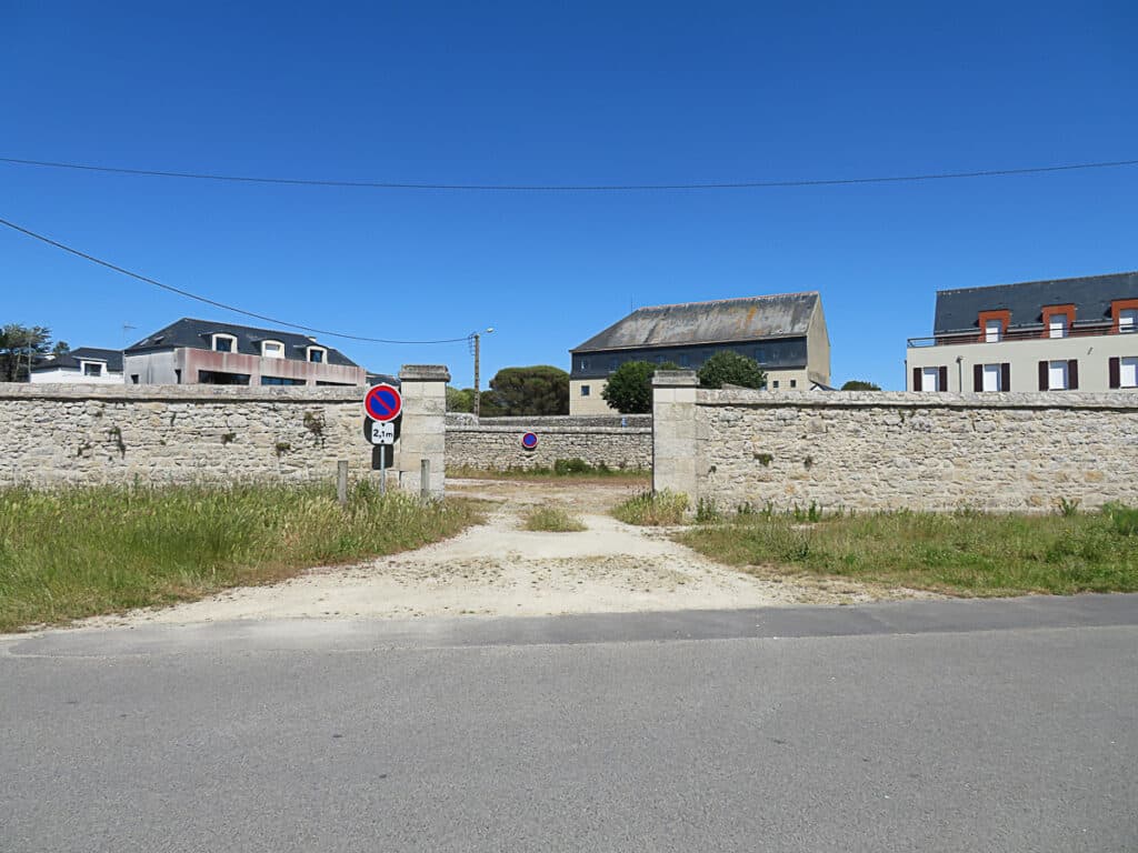
1847 – La ville concède au Département de la Guerre, tout en réservant ses droits, un terrain de 864 m2 pour construire un parc destiné au stockage des boulets d’artillerie.
1847 – Ar gêr a ra da Zepartamant ar Brezel, en ur virout he gwirioù, un dachenn 864 m² evit sevel ur park da stokañ boledoù an artilherezh.
1847 – The town grants the War Department, while reserving its rights, a plot of 864 m² to build a yard for storing artillery cannonballs.
La tour des prisonniers – Tour ar Brizonidi – The Prisoners’ tower
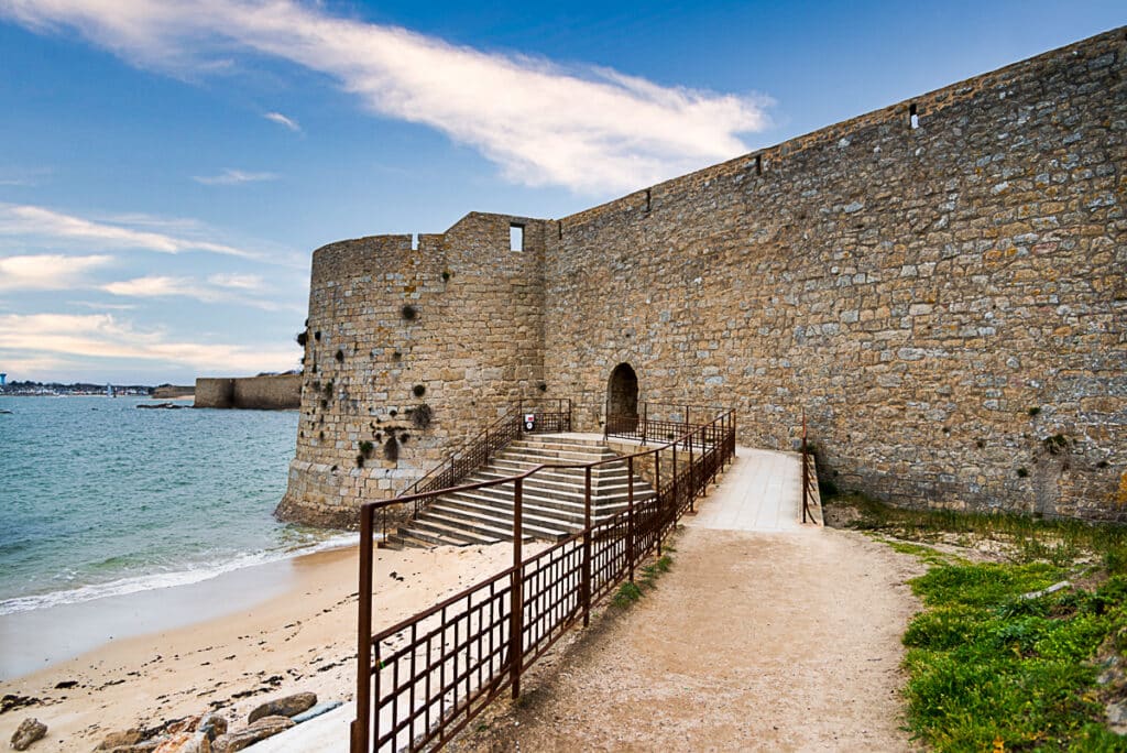
- Doit son nom à l’île des Prisonniers appelée aujourd’hui « ÎLE AUX SOURIS ».
- La poterne des Prisonniers donne accès à la côte par un escalier monumental, détruit pendant la Seconde Guerre mondiale, et récemment restauré.
- La Tour des Prisonniers défendait l’entrée de la poterne.
- Elle est construite dans un appareil régulier aux joints rouges faits de tuiles concassées.
Elle appartient au mur d’enceinte classé Monument Historique le 12 mai 1933.
En langue bretonne – Er brezhoneg
- Donet a ra hec’h anv ag Enez ar Brizonidi, a vez graet « an enezig » anezhi e brezhoneg.
- Dre dor ar Brizonidi e c’heller monet d’an aod dre ur skalier bras, a zo bet distrujet e-pad an Eil Brezel-bed hag adsavet nevez zo
- Tour ar Brizonidi a zifenne an nor.
- Savet eo bet get mein renket ingal, get joentroù ruz graet get teol pilet.
- Lodenn eo ag ar vagoer-dro rummet evel Monumant Istorel d’an 12 a viz Mae 1933.
En anglais – In english
- It takes its name from the Île des Prisonniers (Prisoners’ Island), now called “ÎLE AUX SOURIS” (Mouse Island)..
- The Prisoners’ postern gives access to the shore by a monumental staircase, destroyed during the Second World War and recently restored
- The Prisoners’ Tower defended the entrance to the postern
- It is built in regular coursed masonry with red joints made of crushed tiles.
- It forms part of the town wall, listed as a Historic Monument on 12 May 1933.
La tour de Gâvres – Tour Gavr – The Gâvres tower
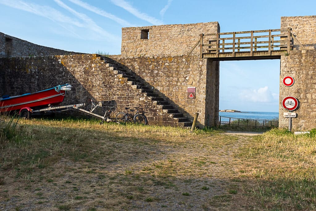
- À l’origine (1649-1653) elle était creuse, les deux meurtrières, encore visibles côté mer, servaient à la défense du fossé.
- Sous la Restauration, elle abritait un magasin à poudres, supprimé en 1825. Cette tour a été comblée de terre et son escalier date de 1850.
- La porte de GÂVRES jouxtant cette tour a été ouverte en 1881.
Elle appartient au mur d’enceinte classé Monument Historique le 12 mai 1933.
En langue bretonne – Er brezhoneg
- Er penn-kentañ (1649-1653) e oa toull, hag an div darzhell, a weler c’hoazh doc’h tu ar mor, a servije da zifenn ar fozell.
- Edan ar Restorasion e oa ur magazin poultr enni, lamet e 1825. Leuniet eo bet an tour-se get douar, ha savet eo bet e skalier e 1850.
- Dor GAVR, a zo just e-tal an tour-se, a zo bet digoret e 1881
Lodenn eo ag ar vagoer-dro rummet evel Monumant Istorel d’an 12 a viz Mae 1933.
En anglais – In english
- Originally (1649-1653) it was hollow; the two loopholes, still visible on the seaward side, served to defend the moat.
- Under the Restoration it housed a powder store, removed in 1825. The tower was filled with earth, and its staircase dates from 1850.
- The GÂVRES gate adjoining the tower was opened in 1881.
It forms part of the town wall, listed as a Historic Monument on 12 May 1933.
La tourelle Saint-François – Tourell Sant-Frañsez – The Saint-François turret
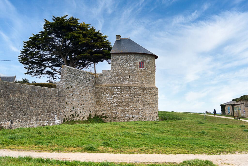
- Dénommée ainsi par le Maréchal de la MEILLERAYE en reconnaissance à saint François d’Assise, fondateur des Frères mineurs des Récollets .
- 1787 – Composée d’un grenier et d’un rez-de-chaussée, elle est occupée par les bœufs employés au service des travaux de fortification.
- 1795 – (An III de la République) – Cette tour est couverte de chaume.
- 1883 – Recouverte d’ardoises, elle est équipée d’un appareil à signaux d’où son nom de : POSTE OPTIQUE ou TOUR OPTIQUE.
Elle appartient au mur d’enceinte classé Monument Historique le 12 mai 1933.
En langue bretonne – Er brezhoneg
- Anvet evel-se get Marichal LA MEILLERAYE en enor da sant Frañsez Asiz, diazezour Breuder vihan ar Rekolezed.
- 1787 – Get ur suler hag ur rez-douar, lakaet e vez enni an ejoned implijet evit labourioù ar c’hreñvadurioù.
- 1795 – (Blez III ar Republik) – Toet eo an tour-se get plouz.
- 1883 – Toet eo get mein-glas ha staliet a zo enni ur benveg-sinaloù, setu perak e vez graet POST OPTIK pe TOUR OPTIK anezhi.
Lodenn eo ag ar vagoer-dro rummet evel Monumant Istorel d’an 12 a viz Mae 1933.
En anglais – In english
- So named by Marshal de LA MEILLERAYE in tribute to Saint Francis of Assisi, founder of the Friars Minor, of whom the Récollets were a branch.
- 1787 – Consisting of a loft and a ground floor, it houses the oxen used for the fortification works.
- 1795 – (Year III of the Republic) – The tower is thatched.
- 1883 – Re-roofed in slate, it is fitted with a signalling apparatus, hence its name: OPTICAL POST or OPTICAL TOWER.
It forms part of the town wall, listed as a Historic Monument on 12 May 1933.
La petite poudrière – Ar Boultrenneg Vihan – The Small Powder Magazine
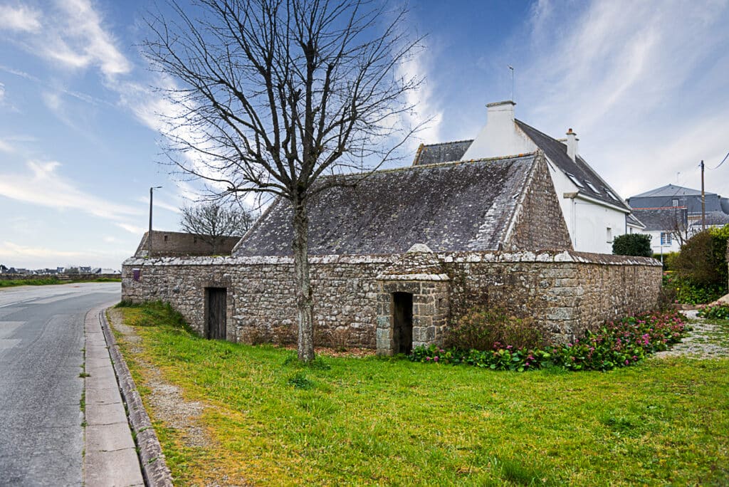
- 1817 – Construction de la Petite Poudrière pour recevoir les poudres des Contributions Indirectes.
Elle remplace un magasin à poudre situé dans la Tour de Gâvres. - 1940 – Des bénévoles vident la Poudrière, brûlent ou noient les poudres avant l’arrivée des Allemands.
- 1952 – Acquisition du Bastion du Papegaut et de la Poudrière par la ville.
Aujourd’hui elle abrite une maquette représentant la cité en 1989 (Échelle 1/500).
En langue bretonne – Er brezhoneg
- Anvet evel-se get Marichal LA MEILLERAYE en enor da sant Frañsez Asiz, diazezour Breuder vihan ar Rekolezed.
- 1787 – Get ur suler hag ur rez-douar, lakaet e vez enni an ejoned implijet evit labourioù ar c’hreñvadurioù.
- 1795 – (Blez III ar Republik) – Toet eo an tour-se get plouz.
- 1883 – Toet eo get mein-glas ha staliet a zo enni ur benveg-sinaloù, setu perak e vez graet POST OPTIK pe TOUR OPTIK anezhi.
Lodenn eo ag ar vagoer-dro rummet evel Monumant Istorel d’an 12 a viz Mae 1933.
En anglais – In english
- So named by Marshal de LA MEILLERAYE in tribute to Saint Francis of Assisi, founder of the Friars Minor, of whom the Récollets were a branch.
- 1787 – Consisting of a loft and a ground floor, it houses the oxen used for the fortification works.
- 1795 – (Year III of the Republic) – The tower is thatched.
- 1883 – Re-roofed in slate, it is fitted with a signalling apparatus, hence its name: OPTICAL POST or OPTICAL TOWER.
It forms part of the town wall, listed as a Historic Monument on 12 May 1933.
Le Papegaut – Ar Papegod – The Papegaut
ORIGINE DU NOM
- 1575 – « Considérant le jeu et industrie de tirer à la harquebuse est honneste et bien requis… », Henri III accorde à BLAVET le privilège du PAPEGAUT.
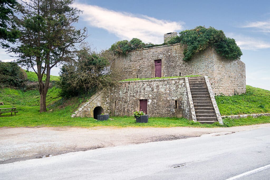
Le vainqueur du concours de tir était celui qui faisait gaule nette c’est à dire abattait d’un seul coup d’arquebuse l’oiseau (un perroquet de bois fixé au haut d’un grand mât) appelé le « joyau ». - 1649-1653 – Ce bastion qui permet la surveillance de la baie de LOCMALO et de la presqu’île de GAVRES devient sous Louis XIV Bastion du PAPEGAUT.
- 1706 – On y établit une batterie de mortiers commandée par François de LAVAL-MONTMORENCY.
- 1770 – suppression du privilège du Papegaut.
- 1878 – L’ingénieur COVILLE : installe une batterie de canons, abaisse les remparts à l’est de la Tour Saint-François, construit des casemates avec retranchements de terre et prolonge la muraille jusqu’à la Grande Porte.
- 1940-45 – Dans le cadre du mur de l’Atlantique, les Allemands construisent plusieurs blockhaus.
- 1993 – Mise en place d’une table d’orientation.
En langue bretonne – Er brezhoneg
ORIN AN ANV
- 1575 – « É kemer e kont ema onest ha rekiz an c’hoari hag ar vicher tennañ get an arkebuz… »), Henri III a ra da VLAÑVEZH gwir-dreist ar PAPEGOD.
- Trec’hour ar genstrivadeg-tenn a oa an heni a ziskare get un taol arkebuz hepken an evn (ur peroked koad staget e lein ur wern vras), anvet « ar bravig ».
- 1649-1653 – Ar bastion-mañ, a ra tro da evezhiañ bae LOKMALOÙ ha gourenez GAVR, a za da vout Bastion ar PAPEGOD edan Loeiz XIV.
- 1706 – Staliet zo ennañ ur strollad mortieroù urzhiet get François de LAVAL-MONTMORENCY.
- 1770 – Lamet eo gwir-dreist ar Papegod.
- 1878 – An ijinour COVILLE : a stalia ur strollad kanonioù, a izela ar ramparzh er reter da Dourell Sant-Frañsez, a sav kazamatoù get kleuzioù douar, a astenn ar vagoer betek an Nor Vras.
- 1940-45 – Meur a vlockhaus, lodenn a Vagoer an Atlantel, a zo savet get an Alamaned.
- 1993 – Staliet a zo un daol-reteriñ.
En anglais – In english
ORIGIN OF THE NAME
- 1575 – “Considering that the game and skill of shooting the harquebus is honourable and much needed…”, Henri III grants BLAVET the privilege of the PAPEGAUT
- The winner of the shooting contest was the one who made a “clean pole”, that is, brought down with a single harquebus shot the bird (a wooden parrot fixed to the top of a tall mast), known as the “jewel”.
- 1649-1653 – This bastion, which overlooks LOCMALO bay and the GÂVRES peninsula, becomes the PAPEGAUT Bastion under Louis XIV.
- 1706 – A mortar battery is set up there under the command of François de LAVAL-MONTMORENCY.
- 1770 – Abolition of the Papegaut privilege.
- 1878 – The engineer COVILLE : installs a battery of cannon, lowers the ramparts east of the Saint-François Tower, builds casemates with earthworks and extends the wall as far as the Grande Porte (Great Gate).
- 1940-45 – As part of the Atlantic Wall, the Germans build several blockhouses.
- 1993 – Installation of an orientation table.
La Criée (salle des fêtes) – Ar C’hoc’hu-pesked (sal ar gouelioù) – La Criée (the village hall)
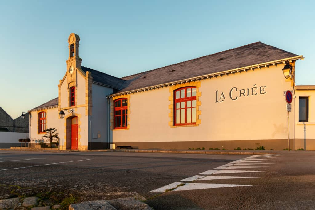
- 1887 – Demande d’une concession d’une criée aux poissons par la Société d’Exploitation et de Construction des Marchés de Paris.
- 1888 – Accord sur les plans de cession à l’entrepreneur de pierres de taille provenant des remparts.
Réception définitive des bâtiments de la CRIÉE. - 1943 – Incendie du bâtiment suite aux bombardements.
- 1946 – Reconstruction de la Criée par la commune.
- 1949 – Location aux Pêcheries Port-Louisiennes.
- 1957 – Transformation de la Criée en salle des Fêtes.
- 2021 – La salle des fêtes prend le nom de La Criée.
En langue bretonne – Er brezhoneg
- 1887 – Goulennet a zo ur goñsesion evit sevel ur c’hoc’hu-pesked get ar Société d’Exploitation et de Construction des Marchés de Paris.
- 1888 – Akord àr ar planioù evit reiñ d’an embreger mein-benerezh tennet ag ar ramparzhioù.
Achu eo da vat labourioù ar C’hoc’hu-pesked. - 1943 – Tan er savadur àr-lerc’h ar bombezadegoù.
- 1946 – Adsavet eo ar C’hoc’hu-pesked get ar gumun.
- 1949 – Feurmet eo d’ar Pêcheries Port-Louisiennes.
- 1957 – Ar C’hoc’hu-pesked a za da vout sal ar Gouelioù.
- 2021 – Sal ar gouelioù a gemer an anv Ar C’hoc’hu-pesked (La Criée).
En anglais – In english
- 1887 – The Société d’Exploitation et de Construction des Marchés de Paris applies for a concession to run a fish auction hall.
- 1888 – Agreement on the plans, with dressed stone from the ramparts to be transferred to the contractor.
Final acceptance of the CRIÉE buildings. - 1943 – The building burns down following the bombing raids.
- 1706 – A mortar battery is set up there under the command of François de LAVAL-MONTMORENCY.
- 1946 – The Criée is rebuilt by the town.
- 1949 – Leased to the Pêcheries Port-Louisiennes.
- 1957 – The Criée is converted into a village hall.
- 2021 – The village hall takes the name La Criée.
Le lavoir de Locmalo – Douet Lokmaloù – The Locmalo wash-house
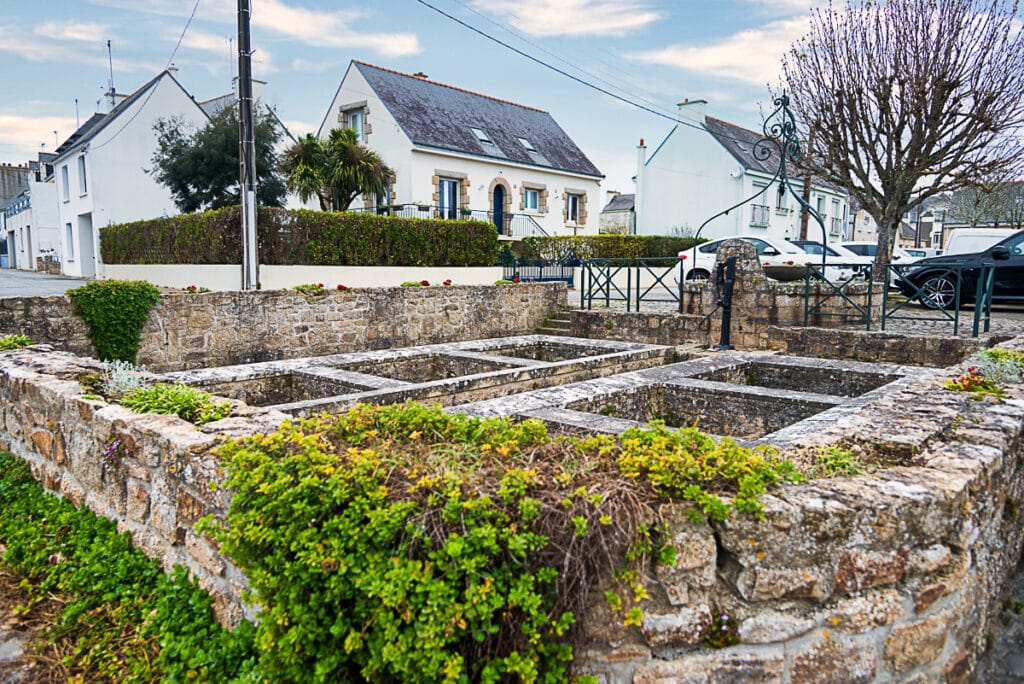
- 1878 – En raison d’une pénurie d’eau, autorisation ministérielle de construire un puits et un lavoir à Locmalo selon le projet de Me Le Clair, adjoint au Génie.
- 1879 – Choix et achat de terrain.
- 1880 – Acceptation des travaux exécutés par l’entrepreneur M. Cartron.
- 1960 – Les dalles de granit, sur lesquelles on savonnait le linge, sont récupérées pour la construction du Mémorial.
- 1967 – Le lavoir est comblé et transformé en parking. Seul subsiste le puits.
- 1992 – Restauration du lavoir.
En langue bretonne – Er brezhoneg
- 1878 – Abalamour d’un diover a zour e ra ar ministr an aotre da sevel ur puñs hag un douet e Lokmaloù, hervez raktres an Ao. Le Clair, eilour en Ijinerezh.
- 1879 – Choazet ha prenet eo an douar.
- 1880 – Asantet eo ar labourioù a vo kaset get an Ao. Cartron, embreger.
- 1960 – Ar vein plat ma veze soavonet an dilhad àrne a zo lamet hag implijet evit sevel ar Memorial.
- 1967 – Stanket eo an douet ha graet ur parklec’h àrnañ. Ar puñs hepken a chom.
- 1992 – Adsavet eo an douet.
En anglais – In english
- 1878 – Owing to a water shortage, ministerial authorisation is granted to build a well and a wash-house at Locmalo, to the design of Mr Le Clair, deputy in the Engineers.
- 1879 – Choice and purchase of the land.
- 1880 – Acceptance of the works carried out by the contractor, Mr Cartron.
- 1960 – The granite slabs on which the washing was soaped are salvaged for the construction of the Memorial.
- 1967 – The wash-house is filled in and turned into a car park. Only the well remains.
- 1992 – Restoration of the wash-house.
Les anciens abattoirs – Ar lazhti kozh – The former slaughterhouse
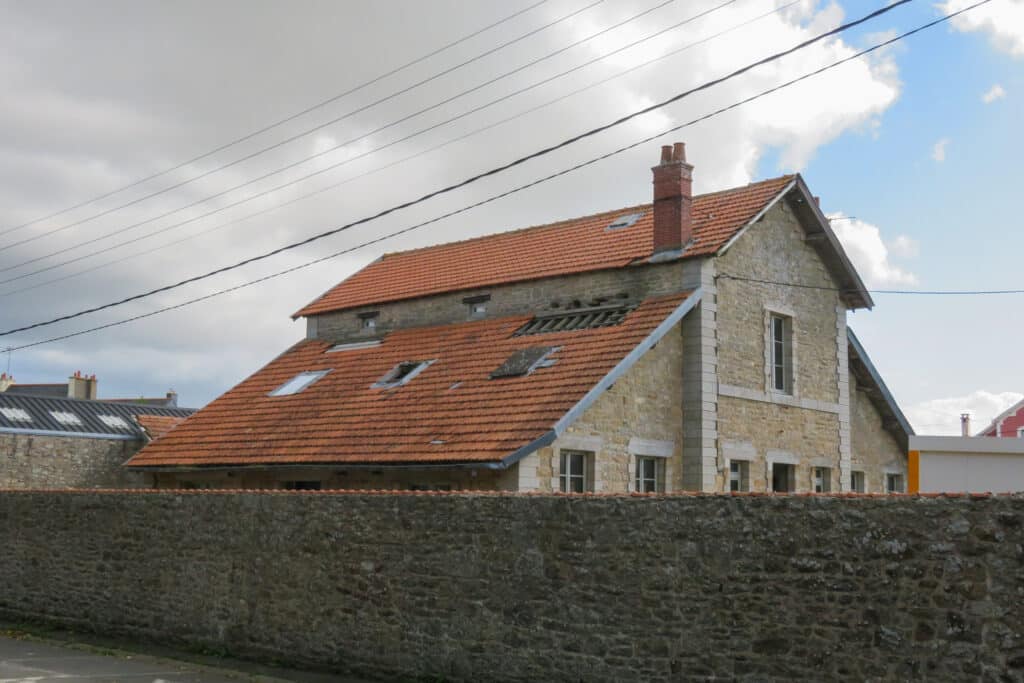
- 1888 – Projet de construction d’un abattoir.
Avis favorable du Conseil Municipal. - 1890 – Refus de la Préfecture.
- 1906 – Reprise du projet de construction d’un abattoir au profit de la Société Générale des Abattoirs de France.
Terrain de 1600 m2.
Concession pour 50 ans. - 1907 – Achèvement des travaux.
- 1933 – Proposition de la Société Générale des Abattoirs de France pour mettre fin à la concession.
- 1962 – Fin de la concession le 26 novembre, les abattoirs deviennent propriété communale et continuent à fonctionner.
- 1972 – Le Conseil Municipal décide la fermeture des abattoirs le 31 mars.
En langue bretonne – Er brezhoneg
- 1888 – Raktres sevel ur lazhti.
Ali a-du ar C’huzul-kêr. - 1890 – Nac’het get ar Prefeti.
- 1906 – Adkemeret eo ar raktres sevel ur lazhti evit ar Société Générale des Abattoirs de France.
Tachenn 1600 m².
Koñsesion evit 50 vlez. - 1907 – Achu eo ar labourioù.
- 1933 – Kennig get ar Société Générale des Abattoirs de France lakaat un termen d’ar goñsesion.
- 1962 – Achu ar goñsesion d’ar 26 a viz Du. Ar lazhti a za da vout perc’henet get ar gumun hag a gendalc’h da vonet en-dro.
- 1972 – Ar C’huzul-kêr a ziviz serriñ ar lazhti d’an 31 a viz Meurzh.
En anglais – In english
- 1888 – Plan to build a slaughterhouse.
Favourable opinion of the Town Council. - 1890 – Refused by the Prefecture.
- 1906 – The slaughterhouse project is revived for the benefit of the Société Générale des Abattoirs de France. Plot of 1,600 m².
50-year concession. - 1907 – Completion of the works.
- 1933 – The Société Générale des Abattoirs de France proposes to end the concession.
- 1962 – The concession ends on 26 November ; the slaughterhouse becomes municipal property and continues to operate.
- 1972 – The Town Council decides to close the slaughterhouse on 31 March.
La chapelle Saint-Pierre – Chapel Sant-Pier – Saint-Pierre chapel
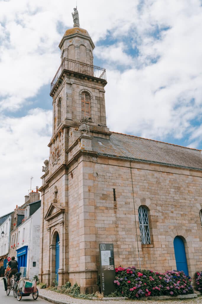
Le bourg de LOC-PERAN ou LOC-PEZRAN possédait à cet emplacement un édifice roman du XIe ou XIIe siècle, dédiée à saint Péran puis à saint Pierre.
- 1553 – Construction d’une chapelle de style gothique flamboyant.
- 1666 – Saint-Pierre cesse d’être une église tréviale pour devenir le siège de la confrérie du Rosaire.
- 1859-1861- Construction de l’église actuelle, de style néo-classique, par l’architecte Michel LE HAGRE.
À l’intérieur, trois retables, des stalles en bois sculpté, trois statues des XVIe – XVIIe siècles et un thonier ex-voto. - 2021 – Restauration des portes.
En langue bretonne – Er brezhoneg
E bourc’h LOKPERAN pe LOKPEZRAN e oa er lec’h-mañ ur savadur roman ag an XIvet pe XIIvet kantved, gouestlet da sant Peran ha goude-se da sant Pier.
- 1553 – Savet a zo ur chapel er stil gotek flamm.
- 1666 – Chapel Sant-Pier a zihan a vout un iliz-drev evit donet da vout sez breuriezh ar Rozera.
- 1859-1861 – Savet eo an iliz a-vremañ, er stil nevez-klasel, get an tisavour Michel LE HAGRE.
En diabarzh, tri retabl, stalloù koad kizellet, teir delwenn ag an XVIvet – XVIIvet kantved hag ur vag-ton ex-voto. - 2021 – Adsavet eo an dorioù.
En anglais – In english
The village of LOC-PERAN or LOC-PEZRAN had on this site a Romanesque building of the 11th or 12th century, dedicated to Saint Péran and later to Saint Peter.
- 1553 – Construction of a chapel in the Flamboyant Gothic style.
- 1666 – Saint-Pierre ceases to be a trève church (chapel of ease) and becomes the seat of the Confraternity of the Rosary.
- 1859-1861 – Construction of the present church, in the neo-classical style, by the architect Michel LE HAGRE.
Inside : three altarpieces, carved wooden stalls, three 16th–17th-century statues and a votive model of a tuna boat. - 2021 – Restoration of the doors.
La fontaine Notre Dame – Feuntan an Itron-VariaThe – Notre-Dame fountain
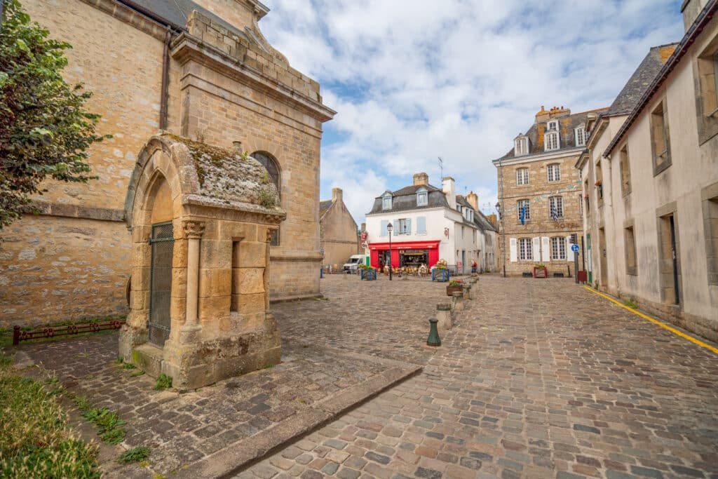
- 1859 – En raison de la pénurie d’eau, projet de construction d’une fontaine PLACE NOTRE-DAME.
- 1863 – De style néo-gothique, édifiée par l’architecte du Département, Émile AMÉ.
Façade amortie par un pignon ogival sculpté de feuilles et de crochets empruntés au style du XIIIe siècle, terminé par un bouquet orné en son milieu d’un « mufle fantastique » en fonte par où arrivait l’eau. Fontaine exécutée en granit de Guern.
- 1995 – Réhabilitation de la fontaine.
En langue bretonne – Er brezhoneg
- 1859 – Abalamour d’an diover a zour, raktres sevel ur feuntan àr BLASENN AN ITRON-VARIA.
- 1863 – Savet eo er stil nevez-gotek get tisavour an Departamant, Émile AMÉ.
Talbenn get ur pignon krommvegek kizellet get delioù ha krogoù amprestet doc’h stil an XIIIvet kantved, get ur bokedad en e lein. E kreiz, ur « vuzell iskis » e houarn-teuz, lec’h ma tevere an dour. Graet eo ar feuntan e greunvaen Gwern.
- 1995 – Adkempennet eo ar feuntan.
En anglais – In english
- 1859 – Owing to the water shortage, a plan to build a fountain on PLACE NOTRE-DAME.
- 1863 – Neo-Gothic in style, built by the Department’s architect, Émile AMÉ.
The façade is finished with a pointed gable carved with leaves and crockets borrowed from the 13th-century style, ending in a finial with, at its centre, a cast-iron “fantastical muzzle” through which the water flowed. The fountain is made of Guern granite.
- 1995 – Rehabilitation of the fountain
Le port de La Pointe – Porzh ar Beg (Porzh ar Poent) – La Pointe harbour
Au Moyen Âge existait une chaussée.
Les navires, y compris ceux de la Compagnie des Indes, mouillaient en rade et les déchargements se faisaient à l’aide de canots et de charrettes à marée basse.
En langue bretonne – Er brezhoneg
Ur chaoser a oa aze er Grennamzer.
Ar listri, re Kompagnunezh an Indez en o mesk, a zihane er vorlenn ha diskarget e vezent get kanotoù, sikouret get karrioù pa veze izel ar mor.
En anglais – In english
In the Middle Ages there was a causeway.
Ships, including those of the Compagnie des Indes, anchored in the roadstead, and unloading was done with small boats and, at low tide, with carts.
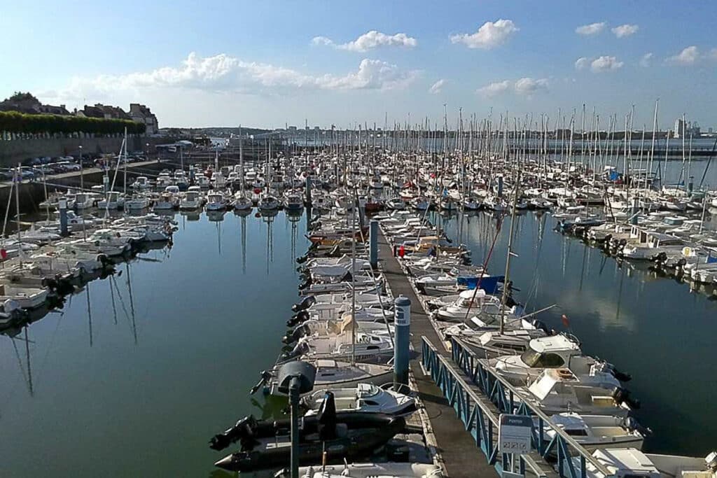
- 1841-1844 – Construction du môle actuel sur les plans de l’ingénieur LAURENT.
- 1902-1914 – Après la crise de la sardine, le port de La Pointe devient un port thonier.
Plus de 100 Dundees en 1910. - 1923-1938 – Essor de la pêche au thon.
- 1938 – Armement de chalutiers motorisés de 50 à 70 cv appelés Pinasses.
- 1940-1945 – Élargissement du quai par les Allemands, construction d’un appontement (aujourd’hui disparu), perpendiculaire au môle.
Construction d’un blockhaus adossé au bastion appelé Tour Carrée. - 1946 – Aménagement d’une glacière sur les plans de l’architecte MARSOLLIER dans la Tour Carrée.
- 1950 – Création et développement de la Coopérative de Mareyage Les Pêcheries Port-Louisiennes.
Aujourd’hui, le port de la Pointe est géré par la Compagnie des Ports du Morbihan. Construction de la Capitainerie sur le môle.
- Port abri pour la pêche et surtout Port de Plaisance.
- Escale des navettes maritimes.
- La glacière est le siège du Centre Nautique et de son école de voile.
En langue bretonne – Er brezhoneg
- 1841-1844 – Savet eo ar mol a-vremañ diàr planioù an ijinour LAURENT.
- 1902-1914 – Goude enkadenn ar sardin e ta porzh ar Beg da vout ur porzh evit ar bagoù-ton.
Oc’hpenn 100 Dundee e 1910. - 1923-1938 – Lañs ar pesketa ton.
- 1938 – Armet zo chaluterioù get moteurioù etre 50 ha 70 cv. Pinasoù a vez graet ag ar bagoù-se.
- 1940-1945 – Ledanaet eo ar c’hae get an Alamaned, savet zo ur peulgae (n’eus ket mui anezhañ bremañ), a-skouer get ar mol.
Savet zo ur blockhaus harpet doc’h ar bastion anvet « an Tour Karrez ». - 1946 – Kempennet zo ur skornlec’h en Tour Karrez, diàr planioù an tisavour MARSOLLIER.
- 1950 – Savet eo ar Gevelouri Mareourezh Les Pêcheries Port-Louisiennes.
Hiziv e vez meret porzh ar Beg get Kompagnunezh Porzhioù ar Mor-Bihan. Savet eo bet ar C’habitendi àr ar mol.
- Porzh-goudor evit ar bagoù pesketa ha dreist-holl Porzh-bageal.
- Ehan ar bagoù a ra an treizh etre Porzh-Loeiz hag an Oriant.
- Ur skol-vageal a zo bremañ er skornlec’h kozh.
En anglais – In english
- 1841-1844 – Construction of the present mole to the plans of the engineer LAURENT.
- 1902-1914 – After the sardine crisis, La Pointe harbour becomes a tuna-fishing port.
More than 100 dundees (tuna sailing boats) in 1910. - 1923-1938 – Boom in tuna fishing.
- 1938 – Fitting out of motorised trawlers of 50 to 70 hp, known as pinasses.
- 1940-1945 – The Germans widen the quay and build a landing stage (since gone) at right angles to the mole.
Construction of a blockhouse against the bastion known as the Tour Carrée (Square Tower). - 1946 – An ice house is fitted out in the Tour Carrée to the plans of the architect MARSOLLIER.
- 1950 – Creation and growth of the fish-wholesaling cooperative Les Pêcheries Port-Louisiennes.
Today La Pointe harbour is managed by the Compagnie des Ports du Morbihan. The harbour master’s office has been built on the mole.
- A harbour of refuge for fishing boats and, above all, a marina.
- Stopping point for the passenger ferries.
- The ice house is the home of the Centre Nautique (watersports centre) and its sailing school.
La place aux canons – Plasenn ar C’hanonioù – Cannon Square
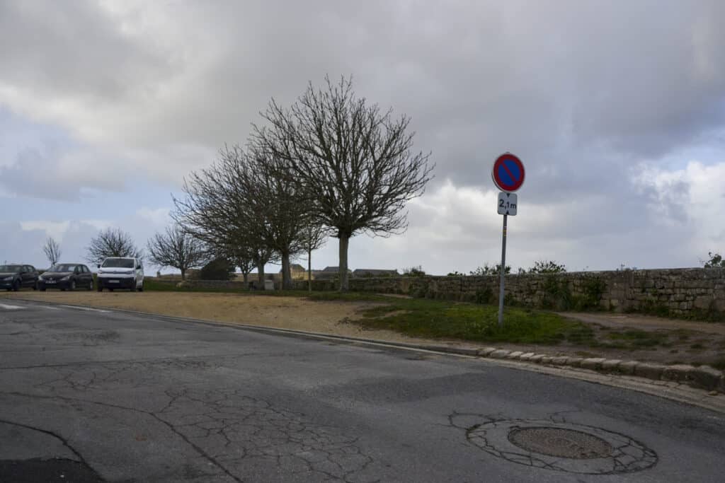
C’est un terre-plein face à l’origine de la rue de la Brèche.
• 1620 – Appelée Place Dauphine.
- 1838 – Devient Place aux Canons car on y conservait les grosses pièces d’artillerie.
- 1886 – Baptisée Square Courbet.
- Guerre 1939-1945 – Les Allemands y installent un blockhaus défendant la rade.
En langue bretonne – Er brezhoneg
Un dachenn blaen eo, e-tal penn straed an Toullad.
- 1620 – Anvet Place Dauphine.
- 1838 – A za da vout Plasenn ar C’hanonioù, rak eno e veze miret ar pezhioù artilherezh bras.
- 1886 – Anvet Square Courbet.
- Brezel 1939-1945 – An Alamaned a stalia eno ur blockhaus hag a zifenn ar vorlenn.
En anglais – In english
This is a level area facing the start of Rue de la Brèche.
- 1620 – Known as Place Dauphine.
- 1838 – Becomes Place aux Canons, because the heavy artillery pieces were kept there.
- 1886 – Named Square Courbet.
- 1939-1945 war – The Germans install a blockhouse there to defend the roadstead.
La fontaine de Marolles – Feuntan Marolles – The Marolles fountain
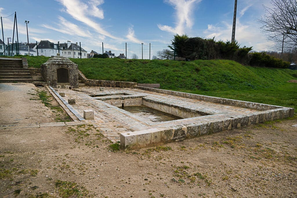
Connue dès 1636, appelée successivement Fontaine du PASTY (1680-1723), puis Fontaine de l’ESPLANADE.
- 1749 – Reconstruite par l’ingénieur de la Place : Pierre de QUATRESOLS Seigneur de MAROLLES qui lui donna son nom actuel.
Son dôme est construit en granit taillé. Elle est précédée d’un douët, lavoir aménagé, sous LOUIS-PHILIPPE (1830-1848).
En langue bretonne – Er brezhoneg
Anavet adal 1636, anvet « Fontaine du PASTY » (1680-1723), ha goude « Fontaine de l’ESPLANADE ».
- 1749 – Adsavet get ijinour ar gêr-greñv Pierre de QUATRESOLS, Aotrou MAROLLES, a ra dezhi hec’h anv ofisiel a-vremañ.
Savet eo he bolz-toenn e greunvaen benet. Dirakzi eh eus un douet, kempennet dindan LOUIS-PHILIPPE (1830-1848).
En anglais – In english
Known from 1636, successively called Fontaine du PASTY (1680-1723), then Fontaine de l’ESPLANADE.
- 1749 – Rebuilt by the fortress engineer, Pierre de QUATRESOLS, Lord of MAROLLES, who gave it its present name.
Its dome is built of dressed granite. In front of it is a douët, a wash-house laid out under LOUIS-PHILIPPE (1830-1848).
Le mémorial des morts de la résistance – Memorial re varv ar Rezistañs – The Memorial to the Resistance dead
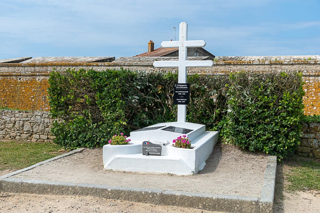
- 23 mai 1945 – Suite à un renseignement, les corps de 69 Résistants abattus par les Allemands, sont découverts dans un ancien stand de tir.
- 1946 – Érection d’une stèle provisoire à la mémoire de ces victimes, avec autorisation d’occupation temporaire du terrain militaire.
- 1960 – Après acquisition par la municipalité d’une parcelle de ce terrain, construction du Mémorial, selon les plans des architectes GUILLOU et LAMOUREC.
- 30 octobre 1960 – Inauguration du Mémorial par monsieur TRIBOULET, ministre des anciens combattants.
La stèle provisoire est conservée et vouée anonymement aux victimes port-louisiennes du nazisme.
- 1975 – Pose de la plaque « Résurrection » par l’Amicale de Ravensbrück.
- 2021- Pose des plaques portant les noms de six résistants morts en déportation et de six résistants fusillés.
En anglais – In english
- 23 a viz Mae 1945 – Kavet zo en ur stand-tenn kozh korfoù 69 Rezistant a oa bet lazhet get an Alamaned.
- 1946 – Savet zo ur maen-koun da c’hortoz e koun ar re varv-se, get an aotre da implij an douar milourel evit ur pennad.
- 1960 – Goude mard eo bet prenet ur lodenn ag an douar-se get ar gumun ema bet savet ar Memorial, hervez planioù an tisavourion GUILLOU ha LAMOUREC.
- 30 a viz Here 1960 – Lidet eo dioueliadur ar Memorial get an Ao. TRIBOULET, ministr ar soudarded kozh.
Miret eo ar maen-koun da c’hortoz ha gouestlet eo d’an dud a Borzh-Loeiz a zo bet lazhet get an Nazied.
- 1975 – Lakaet eo ar blakenn « Résurrection » get Kenseurtiezh Ravensbrück.
- 2021 – Lakaet eo ar plakennoù get anvioù c’hwec’h rezistant marv en deportadegoù ha c’hwec’h rezistant fuzuilhet.
En langue bretonne – Er brezhoneg
- 23 May 1945 – Acting on information received, the bodies of 69 Resistance fighters killed by the Germans are discovered in a former shooting range.
- 1946 – A temporary memorial stone is erected in memory of these victims, with permission for temporary occupation of the military land.
- 1960 – After the municipality acquires a parcel of this land, the Memorial is built to the plans of the architects GUILLOU and LAMOUREC.
- 30 October 1960 – The Memorial is inaugurated by Mr TRIBOULET, Minister for Veterans.
The temporary stone is preserved and dedicated anonymously to the Port-Louis victims of Nazism.
- 1975 – The “Resurrection” plaque is placed by the Amicale de Ravensbrück (Ravensbrück survivors’ association).
- 2021 – Plaques are placed bearing the names of six Resistance fighters who died in deportation and six who were shot.
Le jardin des cloches – Jardrin ar C’hleier – The Bell garden
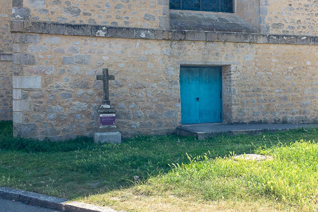
Son emplacement prend le nom de JARDIN DES CLOCHES en raison de la construction d’un appentis abritant les cloches, avant l’édification du clocher actuel (1851).
- XVIIe siècle – Un cimetière existait près de l’Église Notre-Dame.
- 1795 – Lors de la Révolution, il est transféré à Kerzo.
- 1990 – Réaménagé par la municipalité en parkings.
En langue bretonne – Er brezhoneg
JARDRIN AR C’HLEIER a zo bet graet ag ar lec’h-se dre ma oa bet savet aze ur lojell da lakaat ar c’hleier, a-raok mard eo bet savet an tour-iliz a-vremañ (1851).
- XVIIvet kantved – Ur vered a oa e-tal Iliz an Itron-Varia.
- 1795 – Savet zo ur vered nevez e Kerzo e-pad an Dispac’h.
- 1990 – Ur parklec’h a zo kempennet get ar gumun.
En anglais – In english
The site takes the name JARDIN DES CLOCHES (Bell Garden) because a lean-to was built there to house the bells before the present bell tower was erected (1851).
- 17th century – A cemetery existed near Notre-Dame Church.
- 1795 – During the Revolution, it is moved to Kerzo.
- 1990 – Redeveloped by the municipality as car parks.
Le château de Kerzo
- 1747 – Afin de protéger Locmalo et le Driasker, on réalise un ouvrage à couronne à l’entrée de la ville appelée l’Avancée.
- 1793-1794 – Une redoute (avec magasin d’artillerie, petite poudrière et corps de garde) est aménagée à la pointe de Kerzo. Elle est reliée par un retranchement de terre à l’ouvrage à couronne de l’Avancée.
- 1857 – Ces constructions sont déclassées. L’ancienne redoute abrite une fabrique d’engrais et on construit un débarcadère en madriers et tonneaux.
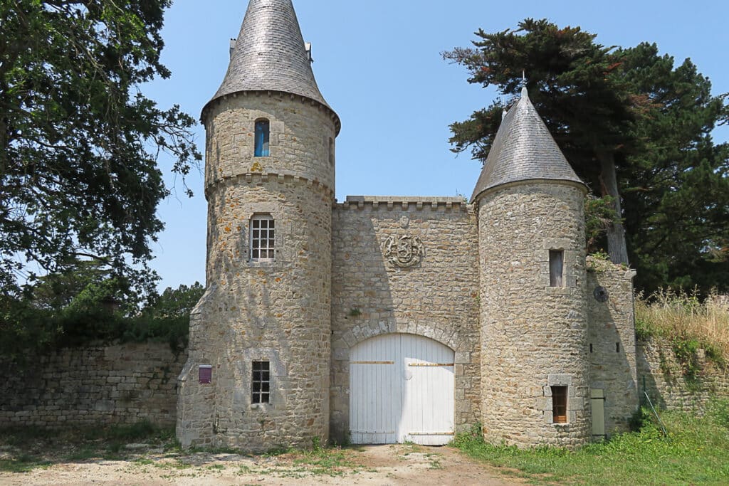
- 1878 – Le Dr Guiheneuc, ancien maire de Port-Louis, achète la propriété et fait construire, sur la redoute, le « château » dont les deux tourelles existent encore.
- 1880 – Jean-Dominique Marquet, maire de Port-Louis, achète le château à la famille Guiheneuc. Il y implante un mégalithe provenant de la commune de Languidic (une stèle du haut Moyen-Âge christianisée).
- XXe siècle – La propriété, demeurée domaine privé, est très endommagée par les bombardements, lors de la guerre de 1939-1945. Subsistent les deux tourelles de l’entrée et la poudrière.
En langue bretonne – Er brezhoneg
- 1747 – Savet zo ur c’hreñvadur-kurunenn anvet « l’Avancée », e antre ar gêr, evit gwareziñ Lokmaloù hag an Driaskêr
- 1793-1794 – Ur redout (get ur magazin artilherezh, ur boultrenneg vihan hag ur c’horf-gward) a zo kempennet e beg Kerzo. Liammet eo get kreñvadur-kurunenn an Avancée dre ur c’hleuz.
- 1857 – Dirummet eo ar savadurioù-se. Ur labouradeg temz a zo staliet er redout kozh ha savet zo ur c’hae-diskargañ get treustoù ha tonelloù.
- 1878 – An Dr Guiheneuc, maer kozh Porzh-Loeiz, a bren an dachenn hag a laka sevel ur maner. E ziv dourig a zo c’hoazh en o sav.
- 1880 – Jean-Dominique Marquet, maer Porzh-Loeiz, a bren ar maner get ar familh Guiheneuc. Lakaat a ra àr an dachenn ur peulvan daet a gumun Langedig (ur maen-sonn ag ar Grennamzer gentañ, bet kristenaet).
- XXvet kantved – Ar maner, chomet prevez, a zo distrujet get ar bombezadegoù e-pad brezel 1939-1945. Ne chom nemet an div dourig a bep tu d’an nor hag ar boultrenneg.
En anglais – In english
- 1747 – To protect Locmalo and the Driasker, a crownwork called the Avancée is built at the entrance to the town.
- 1793-1794 – A redoubt (with an artillery store, a small powder magazine and a guardhouse) is laid out on Kerzo point. It is linked by an earthwork to the crownwork of the Avancée.
- 1857 – These works are decommissioned. The former redoubt houses a fertiliser factory, and a landing stage of planks and barrels is built.
- 1878 – Dr Guiheneuc, former mayor of Port-Louis, buys the property and has the “castle” built on the redoubt; its two turrets still stand.
- 1880 – Jean-Dominique Marquet, mayor of Port-Louis, buys the castle from the Guiheneuc family. He sets up there a megalith from the commune of Languidic (a Christianised early-medieval standing stone).
- 20th century – The property, still privately owned, is badly damaged by bombing during the 1939-1945 war. The two entrance turrets and the powder magazine survive.
Le cimetière – Ar vered – The cemetery
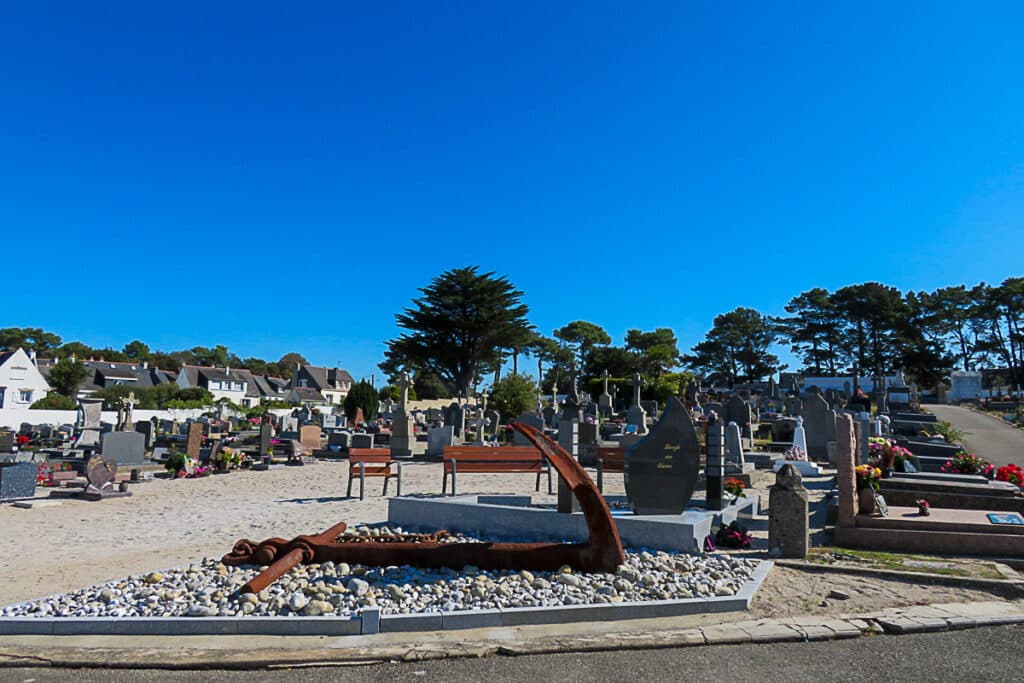
- 1795 – La municipalité acquiert une friche sise à la pointe de Kerzo pour y transférer les cimetières jouxtant l’église Notre-Dame et la chapelle Saint-Pierre.
- 1920 – Construction du monument aux morts à la mémoire des victimes de la guerre 1914-1918 et ultérieurement pose de nouvelles plaques commémoratives lors des autres conflits du XXe siècle.
- 2016 – Création d’un Jardin du souvenir accueillant les cendres des personnes incinérées. Un certain nombre de personnalités locales ou nationales sont enterrées dans ce cimetière.
À proximité du cimetière, la friche de Kerzo a abrité :
- de 1945 à 1960, des baraquements pour reloger les sinistrés de la guerre.
- À partir de 1950-1960, des pavillons individuels avec jardins ont complété l’urbanisation.
En langue bretonne – Er brezhoneg
- 1795 – Ar gumun a bren un douar fraost e beg Kerzo evit sevel ur vered nevez, kement-se a-benn dilec’hiañ ar re a oa e-tal iliz an Itron-Varia ha chapel Sant-Pier.
- 1920 – Savet eo monumant ar re varv e koun ar re a zo marv er brezel 1914-1918. Diwezhatoc’h eh eus bet lakaet plakennoù-koun nevez goude brezelioù all an XXvet kantved.
- 2016 – Savet zo ur Jardrin-koun evit degemer ludu an dud losket. Meur a zen brudet, ag ar vro pe ag ar Stad, a zo douaret er vered-mañ.
Tost d’ar vered, e fraost Kerzo eh eus bet savet :
- adal 1945 betek 1960 : barakennoù evit lojañ ar re o doa kollet o zi get ar brezel.
- Adal 1950-1960 : tier nevez, ur jardrin get pep unan.
En anglais – In english
- 1795 – The municipality acquires a piece of waste land on Kerzo point to relocate there the cemeteries adjoining Notre-Dame church and Saint-Pierre chapel.
- 1920 – Construction of the war memorial in memory of the victims of the 1914-1918 war; new commemorative plaques were later added for the other conflicts of the 20th century.
- 2016 – Creation of a Garden of Remembrance to receive the ashes of those who have been cremated. A number of local and national figures are buried in this cemetery.
Near the cemetery, the Kerzo waste land was home to :
- from 1945 to 1960, huts to rehouse those made homeless by the war.
- From 1950-1960 onwards, detached houses with gardens completed the urbanisation.
L’église Notre-Dame – Iliz an Itron-Varia – Notre-Dame church
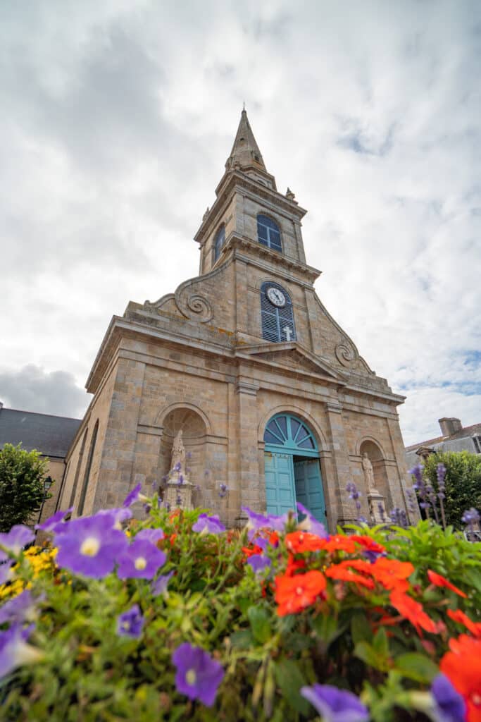
- 1657 – Fondation de l’église Notre-Dame de l’Assomption par le duc de la Meilleraye, gouverneur de Port-Louis, et son épouse Marie de Cossé-Brissac.
- Édifice à nef unique, en forme de croix latine.
- À l’origine, un simple clocher de bois et d’ardoise surmontait la croisée du transept.
- riche mobilier : grand retable de tuffeau, lambris. Pendant la Révolution, le mobilier et l’orfèvrerie sont spoliés et l’église convertie en dépôt de matériel.
- 1795
– Le cimetière avoisinant est transféré à Kerzo.
– Le clocher d’ardoises est démoli. Les cloches sont déposées sous un petit abri, près de l’église dans ce qui devient le « jardin des cloches ». - 1851-1853 – Une nouvelle façade occidentale, intégrant un clocher-porche en pierre, est édifiée par Michel Le Hagre, architecte-entrepreneur
- Années 1870 – Mise en place des statues de la façade (Vierge et saint Jean-Baptiste), des vitraux, des stalles.
- Mai 1918, un incendie accidentel ravage la charpente, les lambris, tout le mobilier de l’église et les vitraux.
- 1920 – Restauration de l’édifice avec voûte en béton armé.
- Années 1930 – Le Docteur Emmanuel Lucas, originaire de Port-Louis, réalise la Descente de croix d’après Rubens (1931), en 1932 une vaste toile à la dimension du chœur : l’Assomption du Titien inspirée de l’église des Frari à Venise. Il reproduit également l’Annonciation (1934), d’après Léonard de Vinci.
- De 1934 à 1937 pose de 8 vitraux composés par le peintre Xavier Josso et exécutés par le maître verrier Champigneulles.
- Seconde Guerre mondiale – Les vitraux volent encore en éclat sous les bombardements et le clocher est endommagé.
- Années 1950
– Bénédiction de nouvelles orgues, électrification des cloches (1949-1950) ;
– Pose de nouveaux vitraux créés par ANDRÉ MÉRIEL-BUSSY et exécutés par le maître-verrier BRIAND (1956-1957) :
côté gauche de la nef :
– la vie de la Vierge (sa naissance, la présentation au temple) ;
dans le transept gauche : Notre-dame de la Mer et de l’Espérance ;
– à gauche du chœur : la Pentecôte ;
– côté droit de la nef : la vie du Christ (l’Annonciation, la Nativité) ;
– dans le transept droit : la Sainte Famille ;
– à droite du chœur : la Crucifixion. - Début du XXIe siècle : Importants travaux de restauration. À remarquer la statue du « Petit Jésus de Prague », dans le transept droit.
En langue bretonne – Er brezhoneg
- 1657 – Divizet eo sevel iliz Itron-Varia Hanter-Eost get dug La Meilleraye, gouarnour Porzh-Loeiz, hag e bried Marie de Cossé-Brissac.
- Savadur get un nev hepken, e stumm ur groaz latin.
- En orin, un tour-iliz eeun e koad ha mein-glas a oa àr groazenn an treuzkorf.
- Gloestraj pinvidik : retabl bras e tufo, koadaj. E-pad an Dispac’h ema bet laeret ar gloestraj hag an aouraj, hag e ta an iliz da vout ur magazin dafar.
- 1795
– Ar vered tost dezhi a zo dilec’hiet da Gerzo.
– Diskaret eo an tour-iliz mein-glas. Lakaet eo ar c’hleier e-barzh ur lojell, tost d’an iliz, er lec’h a za da vout « jardrin ar c’hleier ». - 1851-1853 – Un talbenn nevez er c’hornôg, get un tour-porched e mein, a zo savet get Michel Le Hagre, tisavour-embreger.
- Blezadoù 1870 – Staliet eo delwennoù an talbenn (ar Werc’hez ha sant Yann-Vadezour), ar gwerennoù-liv, ar stalloù.
- Mae 1918 – Un tan-gwall a zistruj ar framm, ar c’hoadaj, ar gloestraj hag ar gwerennoù-liv.
- 1920 – Adsavet eo an iliz, get ur volz e beton armet.
- Blezadoù 1930 – An Dr Emmanuel Lucas, a Borzh-Loeiz, a liv an Diskenn ag ar Groaz diàr Rubens (1931), hag e 1932 ur lien bras a-vent get ar c’hor : Pignidigezh ar Werc’hez gant Titian, awenet get heni iliz ar Frari e Venezia. Adober a ra ivez Kemenn an Ael (1934), diàr Leonardo da Vinci.
- Etre 1934 ha 1937 eh eus bet lakaet 8 gwerenn-liv krouet get ar livour Xavier Josso ha graet get ar mestr-gwerour Champigneulles.
- Eil Brezel-bed – Ar gwerennoù-liv a zo torret en-dro get ar bombezadegoù, ha gwallaozet eo an tour-iliz.
- Blezadoù 1950
– Benniget eo an ograoù nevez, tredanekaat eo ar c’hleier (1949-1950) ;
– Lakaet zo gwerennoù-liv nevez, krouet get ANDRÉ MÉRIEL-BUSSY ha graet get ar mestr-gwerour BRIAND (1956-1957) :
– tu kleiz an nev : buhez ar Werc’hez (he ganedigezh, ar c’hennig en templ) ;
– en treuzkorf kleiz : Itron-Varia ar Mor hag an Esperañs ;
– a-gleiz d’ar c’hor : ar Pantekost ;
– tu dehou an nev : buhez ar C’hrist (Kemenn an Ael, ar Ganedigezh) ;
– en treuzkorf dehou : ar Familh Santel ;
– a-zehou d’ar c’hor : ar Groazidigezh. - Penn-kentañ an XXIvet kantved : labourioù adsevel bras. Da welet : delwenn « Jezuz Bihan Praha », en treuzkorf dehou.
En anglais – In english
- 1657 – Foundation of the church of Notre-Dame de l’Assomption (Our Lady of the Assumption) by the Duke of La Meilleraye, governor of Port-Louis, and his wife Marie de Cossé-Brissac.
- A single-nave building, in the shape of a Latin cross.
- Originally, a simple bell tower of wood and slate rose above the crossing.
- Rich furnishings: a large tufa altarpiece, wood panelling. During the Revolution, the furnishings and silverware are plundered and the church is turned into an equipment store.
- 1795
– The neighbouring cemetery is moved to Kerzo.
– The slate bell tower is demolished. The bells are placed under a small shelter near the church, on what becomes the “Bell Garden”. - 1851-1853 – A new west front, incorporating a stone tower-porch, is built by Michel Le Hagre, architect and contractor.
- 1870s – Installation of the statues on the front (the Virgin and Saint John the Baptist), the stained-glass windows and the stalls.
- May 1918 – An accidental fire destroys the roof timbers, the panelling, all the church furnishings and the stained glass.
- 1920 – Restoration of the building with a reinforced-concrete vault.
- 1930s – Doctor Emmanuel Lucas, a native of Port-Louis, paints the Descent from the Cross after Rubens (1931) and, in 1932, a vast canvas the size of the chancel: the Assumption after Titian, inspired by the one in the Frari church in Venice. He also reproduces the Annunciation (1934), after Leonardo da Vinci.
- From 1934 to 1937, installation of 8 stained-glass windows designed by the painter Xavier Josso and made by the master glazier Champigneulles.
- Second World War – The stained glass is shattered again by the bombing and the bell tower is damaged.
- 1950s
– Blessing of a new organ, electrification of the bells (1949-1950) ;
– Installation of new stained-glass windows designed by ANDRÉ MÉRIEL-BUSSY and made by the master glazier BRIAND (1956-1957) :
– left side of the nave: the life of the Virgin (her birth, the presentation in the Temple) ;
– in the left transept: Our Lady of the Sea and of Hope ;
– left of the chancel: Pentecost ;
– right side of the nave: the life of Christ (the Annunciation, the Nativity) ;
– in the right transept: the Holy Family ;
– right of the chancel: the Crucifixion. - Early 21st century: major restoration works. Note the statue of the “Infant Jesus of Prague” in the right transept.
L’office de tourisme (la gare) – Ti an douristed (ti-gar kozh) – The tourist office (the railway station)
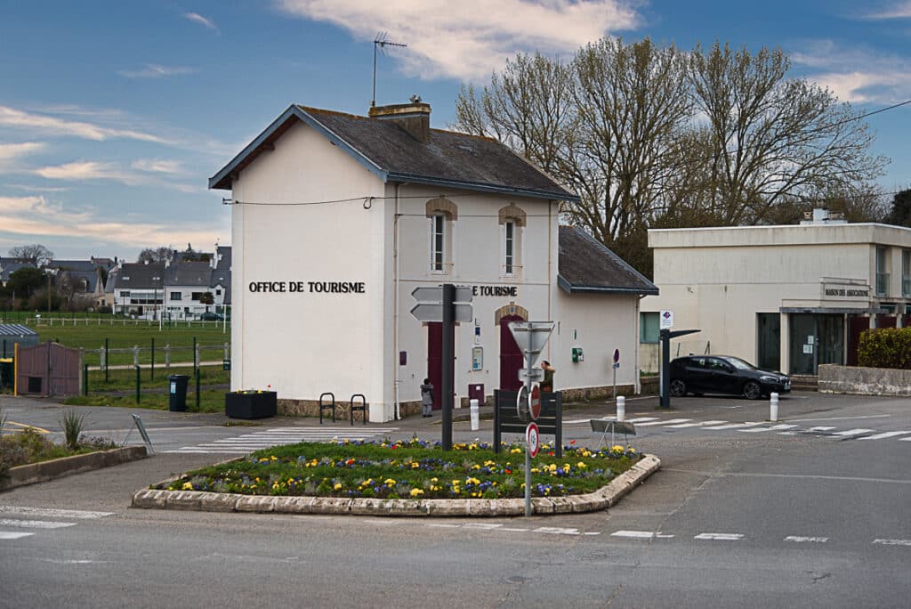
- 1884 – Pourparlers en vue de construire une ligne de chemin de fer appartenant au réseau des chemins de fer d’intérêt local du Morbihan et allant de Port-Louis à Hennebont et Baud.
- 1905 – Acquisition du terrain pour l’établissement de la gare et de ses dépendances dans l’anse du Driasker.
- 1911 – Début des travaux, interrompus par des difficultés techniques puis par la Première Guerre mondiale.
- 4 septembre 1921 – Inauguration de la gare et de la ligne.
- 1932 – Supplantée par le développement du trafic routier et du transport en commun automobile.
Cette ligne, dernière ouverte dans le département, est la première fermée.
La gare a été conservée et accueille aujourd’hui l’Office du Tourisme.
En langue bretonne – Er brezhoneg
- 1884 – Divizoù evit sevel ur linenn hent-houarn e rouedad hentoù-houarn lec’hel ar Mor-Bihan, a Borzh-Loeiz da Hennbont ha Baod.
- 1905 – Prenet eo an dachenn evit sevel an ti-gar hag e savadurioù stag e foñs pleg-mor an Driaskêr.
- 1911 – Kroget eo ar labourioù, dihanet get diaesterioù teknikel ha goude get ar Brezel-bed Kentañ.
- 4 a viz Gwenholo 1921 – Lidet eo digoradur an ti-gar hag ar linenn.
- 1932 – Lakaet eo a-gostez get kresk an tremenerezh àr an hentoù hag an treuzdougen boutin dre otokarrioù.
Ar linenn-se, an heni ziwezhañ a zo bet digoret en departamant, a zo an heni gentañ a zo bet serret.
Miret eo bet an ti-gar, hag ennañ ema hiziv Ti an douristed.
En anglais – In english
- 1884 – Talks with a view to building a railway line on the Morbihan local-interest network, running from Port-Louis to Hennebont and Baud.
- 1905 – Purchase of the land for the station and its outbuildings in the Driasker cove.
- 1911 – Work begins, but is interrupted by technical difficulties and then by the First World War.
- 4 September 1921 – Inauguration of the station and the line.
- 1932 – Superseded by the growth of road traffic and of motor public transport.
This line, the last to open in the department, was the first to close.
The station has been preserved and today houses the Tourist Office.
Les anciennes écuries – Ar marchosioù kozh – The former stables
Construites sous Louis XV, pendant la guerre de Sept ans (1756-1763), pour héberger les chevaux de l’Artillerie qui n’avaient pas leur place dans la citadelle.
Deux bâtiments similaires, à l’intérieur de l’enceinte, et adossés au rempart de part et d’autre de la Porte de Gâvres, comportaient un rez-de-chaussée pour les chevaux et un grenier pour le fourrage.
En langue bretonne – Er brezhoneg
Savet edan Loeiz XV, e-pad Brezel ar Seizh Vlez (1756-1763), evit lojañ kezeg an Artilherezh, n’o doa ket a lec’h er sitadell..
Daou savadur heñvel an eil doc’h egile, harpet doc’h ar ramparzh a bep tu da Zor Gavr, o doa ur rez-douar evit ar roñsed hag ur suler evit ar foenn.
En anglais – In english
Built under Louis XV, during the Seven Years’ War (1756-1763), to house the Artillery horses for which there was no room in the citadel.
Two similar buildings inside the walls, backing onto the rampart on either side of the Gâvres Gate, had a ground floor for the horses and a loft for the fodder.
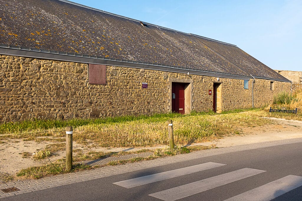
- 1867 – Une tempête ravage le rempart situé à l’ouest de la Porte de Gâvres et le bâtiment qui est derrière.
- 1874 – Démolition du bâtiment endommagé.
- Début du XXe siècle, le bâtiment actuel a servi d’entrepôt pour les usines de conserves de sardines puis a été laissé à l’abandon.
- 2008 – Ce bâtiment, devenu Local des Jeunes, a été dédié à la mémoire de Lisette Moru, jeune Résistante, morte en déportation en 1943.
En langue bretonne – Er brezhoneg
- 1867 – Ur barr-amzer bras a zistruj ar ramparzh er c’hornôg da Zor Gavr hag ar savadur a zo a-dreñv.
- 1874 – Diskaret eo ar pezh a chom ag ar savadur.
- E penn-kentañ an XXvet kantved ema bet implijet ar savadur a-vremañ evel magazin evit ar frinterezhioù sardin, ha dilezet eo bet goude.
- 2008 – Ar savadur-se, daet da vout Ti ar Re Yaouank, a zo bet gouestlet da goun Lisette Moru, Rezistantez yaouank, marv en deportadeg e 1943.
En anglais – In english
- 1867 – A storm wrecks the rampart west of the Gâvres Gate and the building behind it.
- 1874 – Demolition of the damaged building.
- In the early 20th century, the surviving building served as a warehouse for the sardine canneries, then was left derelict.
- 2008 – This building, now the Youth Centre, was dedicated to the memory of Lisette Moru, a young Resistance fighter who died in deportation in 1943.
Les halles du marché – Koc’hu ar marc’had – The market halls
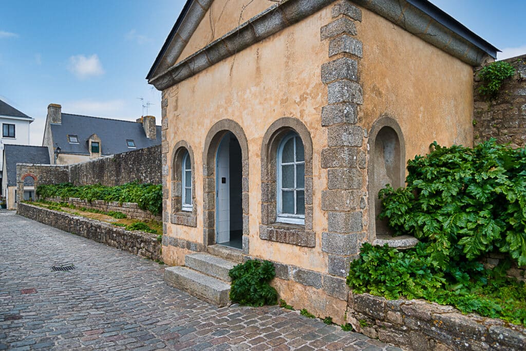
- 1762 – Édifiées sur le côté est de l’actuelle place du Marché, elles étaient formées de petites échoppes surmontées d’un large toit et fermées de deux vantaux, l’un servant d’auvent et l’autre d’étal.
Le Pavillon central à fronton triangulaire abritait le « poids du Roi ».
Elles ont été reconstruites en 1848, puis rasées en 1971.
Le pavillon central a été restauré pour servir de toilettes en 2000.
En langue bretonne – Er brezhoneg
- 1762 – Savet e tu reter plasenn ar Marc’had, graet e oant get ur steudennad stalioù bihan, un doenn ledan àrne ha serret get daou stalaf, unan a servije da zisglaver/disheoler hag egile da daol-stal.
Er pavilhon kreiz, get e dalbenn tric’hornek, e oa « pouez ar Roue ».
Adsavet e oant bet e 1848, ha diskaret e 1971.
Adsavet eo bet ar pavilhon kreiz evit gober privezioù anezhañ e 2000.
En anglais – In english
- 1762 – Built on the east side of the present Place du Marché, they consisted of small stalls under a wide roof, closed by two shutters, one serving as an awning and the other as a counter.
The central pavilion, with its triangular pediment, housed the “King’s weights”.
They were rebuilt in 1848, then demolished in 1971.
The central pavilion was restored in 2000 to serve as public toilets.
La porte sardinière – Dor ar Sardrin – The Sardine gate
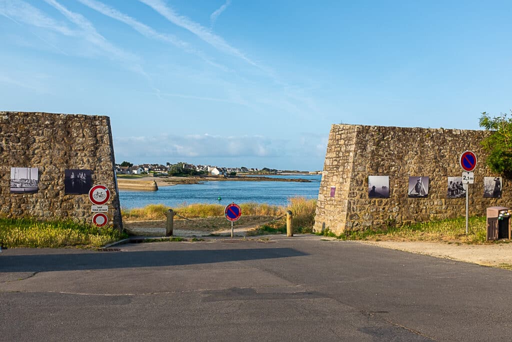
Cette porte avait autrefois une arcade.
Élargie au début du XXe siècle pour faciliter l’accès aux conserveries situées à l’intérieur des remparts.
La chaussée qui descend vers la mer est la première jetée construite en 1851.
En langue bretonne – Er brezhoneg
Ur wareg-volz a oa a-us d’an nor-mañ gwezharall.
Ledanaet eo bet e penn-kentañ an XXvet kantved evit aesaat ar moned-ha-doned etre an aod hag ar frinterezhioù.
Ar chaoser a ziskenn betek ar mor a zo an heni kentañ a zo bet savet e 1851.
En anglais – In english
This gate once had an arch.
Widened in the early 20th century to ease access to the canneries located inside the ramparts.
The causeway running down to the sea is the first jetty, built in 1851.
Les vestiges du Fort-Coville – Ar pezh a chom a Fort-Coville – The remains of Fort Coville
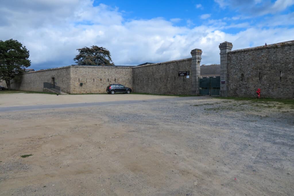
En 1965, une école maternelle a été ouverte sur l’emplacement du Fort-Coville, édifié en 1880 par Henri Coville, commandant du Génie.
C’était le bastion central de l’ancienne ligne de défense de l’Avancée, établie dès 1747 par le directeur des Fortifications de Bretagne Amédée-François Frezier.
Il n’en reste que le mur d’enceinte.
En langue bretonne – Er brezhoneg
E 1965 e oa bet digoret ur skol-vamm er lec’h ma oa Fort-Coville, savet e 1880 get Henri Coville, komandant an Ijinerezh.
Bastion kreiz linenn zifenn kozh an Avancée e oa, savet adal 1747 get rener Kreñvadurioù Breizh, Amédée-François Frezier.
Ar vagoer-dro hepken a chom anezhañ.
En anglais – In english
In 1965, a nursery school was opened on the site of Fort Coville, built in 1880 by Henri Coville, commander of the Engineers.
It was the central bastion of the former Avancée defensive line, established from 1747 by the director of Fortifications for Brittany, Amédée-François Frezier.
Only the enclosure wall remains.
La tour de Nesmond – Tour Nesmond – The Nesmond tower
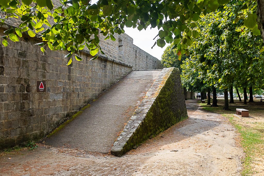
Elle apparaît sur les plans jusqu’en 1717.
On lui a donné le nom d’un grand chef d’escadre de Louis XIV que le Port-Louis accueillait avec ses prises entre 1690 et 1703.
Elle était située un peu avant l’emplacement de la rampe actuelle.
En langue bretonne – Er brezhoneg
Gwelet e vez àr ar c’hartennoù betek 1717.
Raet e oa bet dezhi anv ur penn-eskadrenn bras da Loeiz XIV, a oa bet degemeret e Porzh-Loeiz get e listri-preizh etre 1690 ha 1703.
Un tammig e-raok lec’h ar rampenn a-vremañ e oa.
En anglais – In english
It appears on plans until 1717.
It was named after a great squadron commander under Louis XIV, whom Port-Louis welcomed with his prizes between 1690 and 1703.
It stood a little before the site of the present ramp.
La Mairie (Ty Huella) – An Ti-kêr (« Ty Huella ») – The Town Hall (Ty Huella)
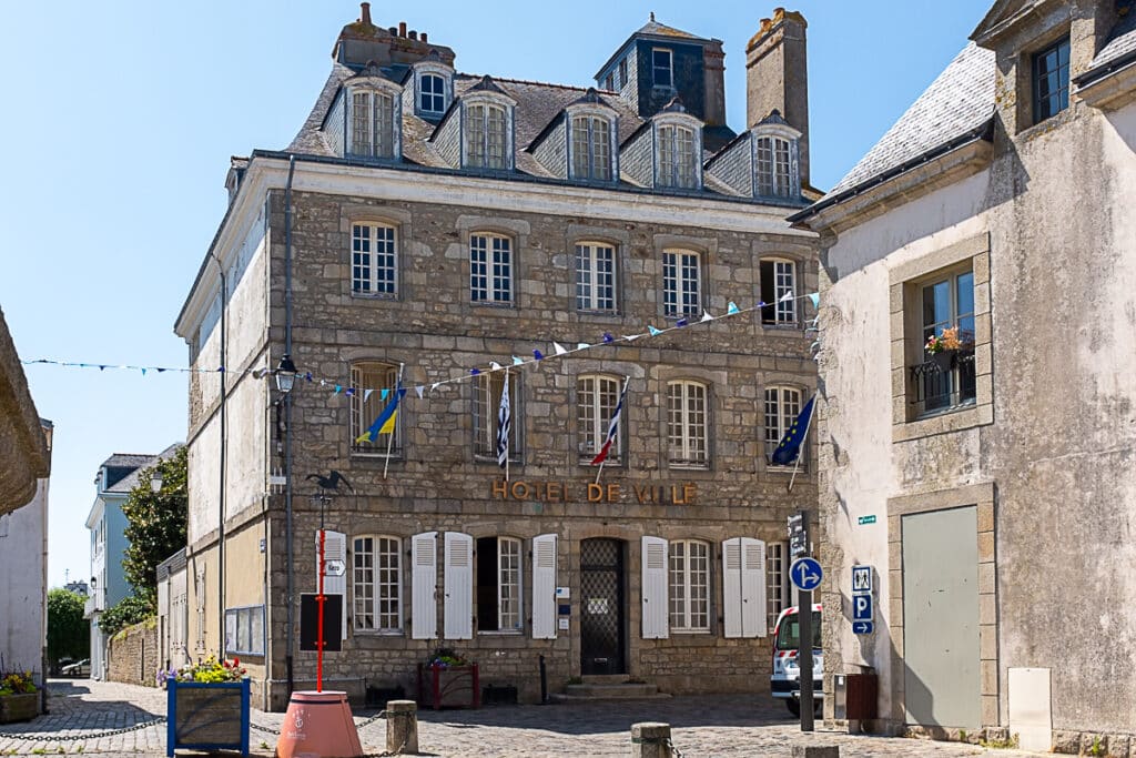
Immeuble de trois étages, construit vers 1770.
Bandeaux en pierre qui séparent les étages, linteaux curvilignes des fenêtres, deux rangées de mansardes sur le toit,
avec une « guette » d’où la vue s’étend sur la rade et jusqu’à Groix.
Bâtie par le chirurgien-major, Dominique Ollivier, elle a été habitée par plusieurs officiers de la Compagnie des Indes, de la Marine Royale et des notables (telle la famille Guiheneuc).
- Guerre 1939-1945 – Siège de la Kommandantur
- 1945 – inscription à l’inventaire des monuments historiques
- 1948 – le Maire Adrien Charrier et le conseil municipal votent l’acquisition pour en faire la mairie.
En langue bretonne – Er brezhoneg
Ti get tri estaj, bet savet tro 1770.
Bandennoù mein a zisrann an estajoù, gourinoù krommet ar fenestroù, div renkad mañsardoù àr an doenn, get ur « ged » lec’h ma c’heller gwelet ar vorlenn ha betek Groe.
Savet get ar surjian-major Dominique Ollivier, meur a dud a-bouez a zo bet é chom en ti-se : ofiserion a Gompagnunezh an Indez, ofiserion ag ar Morlu Roueel ha pennoù-bras arall (evel familh Guiheneuc).
- Brezel 1939-1945 – Sez ar C’hommandantur.
- 1945 – Enskrivet e renabl ar monumantoù istorel.
- 1948 – Ar Maer Adrien Charrier hag ar c’huzul-kêr a vot evit prenañ an ti ha gober an ti-kêr anezhañ.
En anglais – In english
A three-storey building, constructed around 1770.
Stone string courses separating the floors, curved window lintels, two rows of dormers on the roof, with a lookout (“guette”) offering a view over the roadstead as far as Groix.
Built by the surgeon-major Dominique Ollivier, it was home to several officers of the Compagnie des Indes and the Royal Navy, and to notable families (such as the Guiheneucs).
- 1939-1945 war – Headquarters of the Kommandantur
- 1945 – added to the register of historic monuments
- 1948 – Mayor Adrien Charrier and the town council vote to purchase it as the town hall.
Télécharger le plan des monuments
Le Bunker Mémoire – Bunker ar Vemoer – The Memory Bunker
Hommage aux 69 martyrs
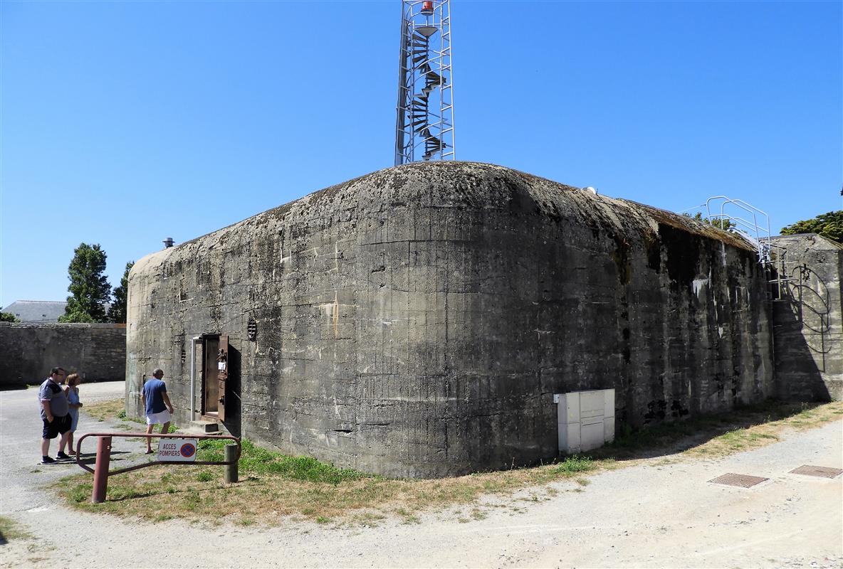
Une première salle rend hommage aux fusillés de la citadelle. Soixante-neuf portraits de ces hommes prennent place sur le mur d’entrée : des résistants détenus à la citadelle, torturés et fusillés, qui furent retrouvés en mai 1945. Dans cette même salle, témoignages, informations sur les rafles complètent le parcours largement illustré de photographies. Un film d’une quinzaine de minutes est projeté pour ponctuer cet hommage.
En langue bretonne – Er brezhoneg
Enor d’an 69 merzher
Ur sal gentañ a ra enor d’ar re a zo bet fuzuilhet er sitadell. Nav poltred ha tri-ugent ag an dud-se a zo àr ar vur : rezistanted dalc’het er sitadell, jahinet ha fuzuilhet, a oa bet kavet o c’horfoù e miz Mae 1945. Er sal-se e kaver ivez testenioù ha titouroù a-ziàr ar rafladegoù, a gloka hent ar weladenn, skeudennaouet get ur bochad fotoioù. Ur film ag ur pemzek munutenn bennak a vez skignet ivez.
En anglais – In english
Tribute to the 69 martyrs
A first room pays tribute to those shot at the citadel. Sixty-nine portraits of these men line the entrance wall: Resistance fighters held at the citadel, tortured and shot, who were found in May 1945. In the same room, testimonies and information on the round-ups complete a route richly illustrated with photographs. A film of around fifteen minutes is screened to round off this tribute.
Port-Louis et la guerre
La suite de la visite concerne la guerre 39-45, traitée chronologiquement à Port-Louis. De tous nouveaux panneaux encadrent les deux grandes maquettes de l’hôpital maritime en 1804 et du couvent des Récollets au XVIIème siècle. Une pièce qui s’attarde également sur les Port-Louisiens, victimes civiles, résistants ou morts en déportation.
Des salles historiques
Elles ponctuent l’ensemble du parcours et sont particulièrement présentes dans la troisième salle, imprégnant les lieux de l ‘ambiance de cette Seconde Guerre mondiale faisant écho aux peintures murales peintes par les Allemands. Un film d’une dizaine de minutes « Le Mur de l’Atlantique » est projeté dans cette pièce.
En langue bretonne – Er brezhoneg
Porzh-Loeiz hag ar brezel
Àr-lerc’h e kendalc’h ar weladenn a-ziàr ar brezel 39-45 e Porzh-Loeiz hervez urzh an amzer. Panelloù nevez-flamm a zo tro-dro d’an div vaketenn vras : keni an ospital-mor e 1804 ha keni kouvant ar Rekolezed en XVIIvet kantved. Tud a Borzh-Loeiz a zo lakaet àr-wel ivez : siviled lazhet, rezistanted ha tud marv en deportadegoù.
Pezhioù istoerel
A-hed hent ar weladenn emaint, ha dreist-holl en trivet sal. Aergelc’h an Eil Brezel-bed a vez santet dreze, evel dre ar livadurioù a zo bet graet àr ar murioù get ar soudarded Alaman. Ur film a zek munutenn bennak, « Magoer an Atlantel », a vez skignet er sal-se.
En anglais – In english
Port-Louis and the war.
The rest of the visit covers the 1939-45 war as it unfolded in Port-Louis, in chronological order. Brand-new panels frame the two large models of the naval hospital in 1804 and of the Récollets convent in the 17th century. This room also dwells on the people of Port-Louis who were civilian victims, Resistance fighters or died in deportation..
Historical rooms
They punctuate the whole route and are particularly present in the third room, steeping the place in the atmosphere of the Second World War and echoing the murals painted by the Germans. A film of around ten minutes, “The Atlantic Wall”, is screened in this room.
Les visites du Bunker s’effectuent durant les vacances et les journées du patrimoine.
E-pad ar vakañsoù-skol ha devezhioù ar glad e vez digor ar Bunker.
Visits to the Bunker take place during school holidays and on Heritage Days.
Le Mémorial – Ar Memorial – The Memorial
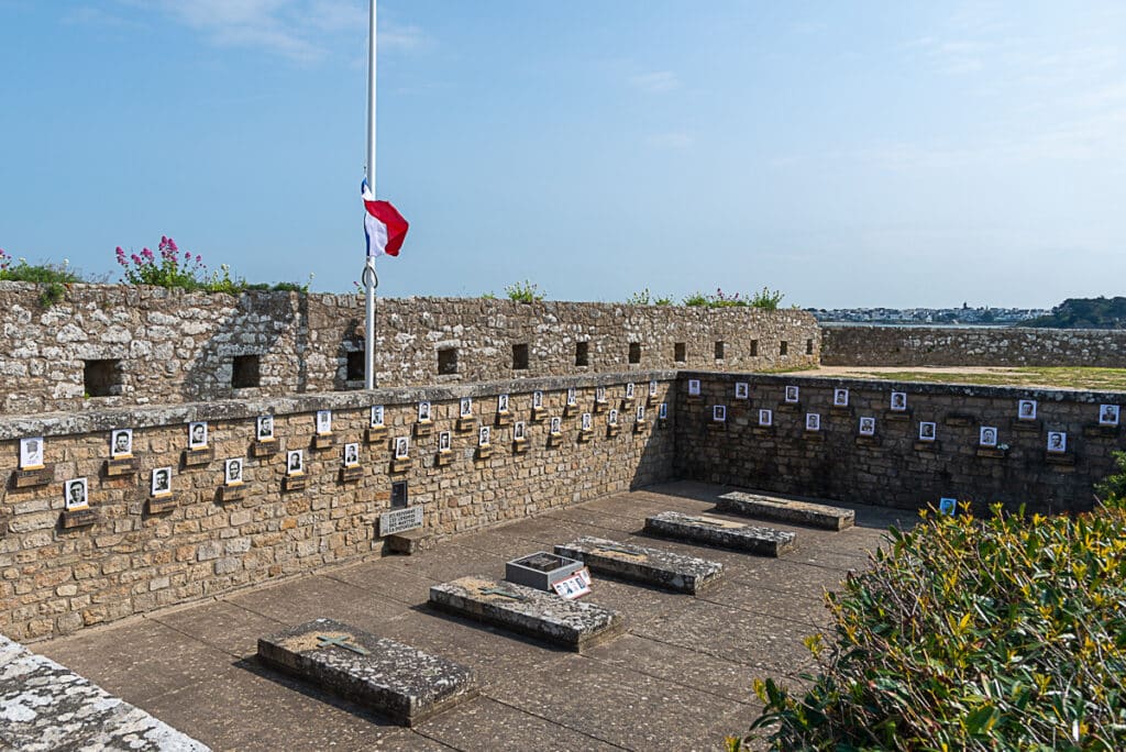
69 corps se trouvaient dans le « Charnier » de la Citadelle de Port-Louis lors de sa découverte, le 18 mai 1945.
63 personnes furent identifiées, 6 sont restées inconnues.
Des recherches effectuées en 2020 ont permis l’identification de 3 d’entre eux et un 4eme en 2021.
Le 23 mai, date choisie pour les commémorations, correspond à la fin des exhumations.
En langue bretonne – Er brezhoneg
69 korf a oa e « Karnel » Sitadell Porzh-Loeiz pa oa bet kavet, d’an 18 a viz Mae 1945.
63 den a oa bet anavet, 6 a zo chomet dianav.
Enklaskoù graet e 2020 o deus raet tro da anavout 3 anezhe, hag ur 4vet e 2021.
An 23 a viz Mae, deiziad dibabet evit al lidoù-koun, a glot get fin an dizouaradegoù.
En anglais – In english
69 bodies lay in the “mass grave” of the Citadel of Port-Louis when it was discovered on 18 May 1945.
63 people were identified ; 6 remained unknown.
Research carried out in 2020 led to the identification of 3 of them, and a 4th in 2021.
23 May, the date chosen for the commemorations, corresponds to the end of the exhumations.
De loc-peran à port-louis ,document historique , histoire d’une cité maritime , à travers les dessins de gèrard Dieul architecte et historien de port-louis.
A Lokperan da Borzh-Loeiz, teul istorel, istoer ur gêr-vor, dre dresadennoù Gérard Dieul, tisavour hag istoerour Porzh-Loeiz.
From Loc-Péran to Port-Louis, a historical document: the story of a maritime town through the drawings of Gérard Dieul, architect and historian of Port-Louis.
Le chemin de mémoire
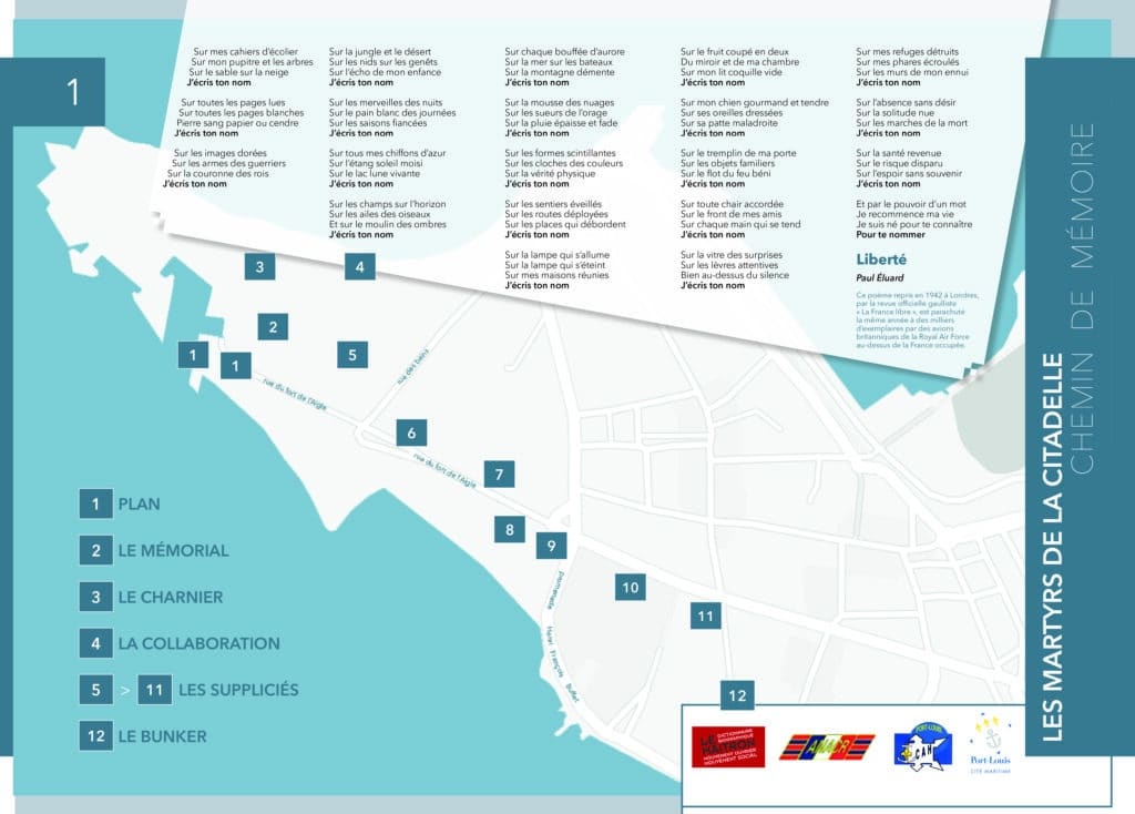
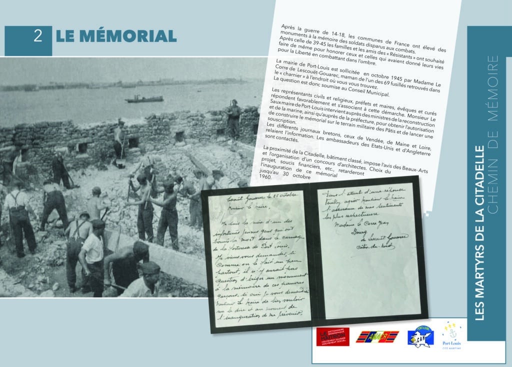
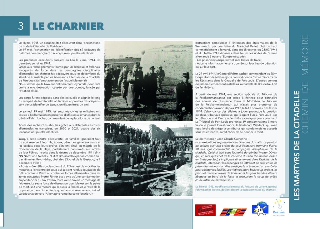
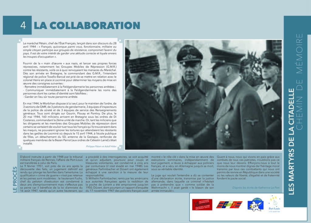
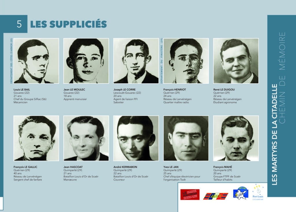
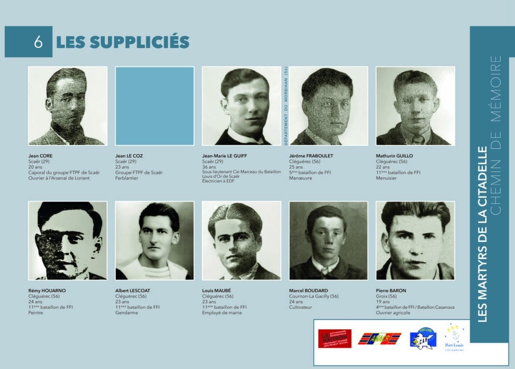
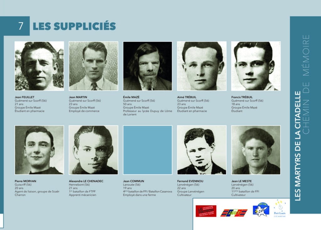
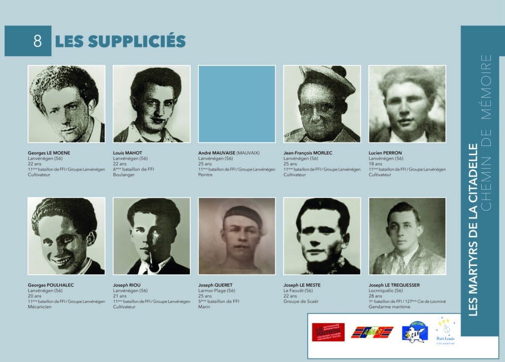
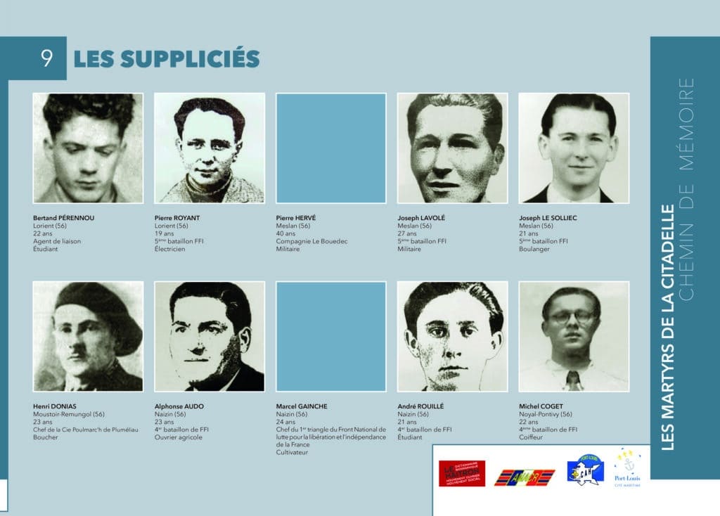
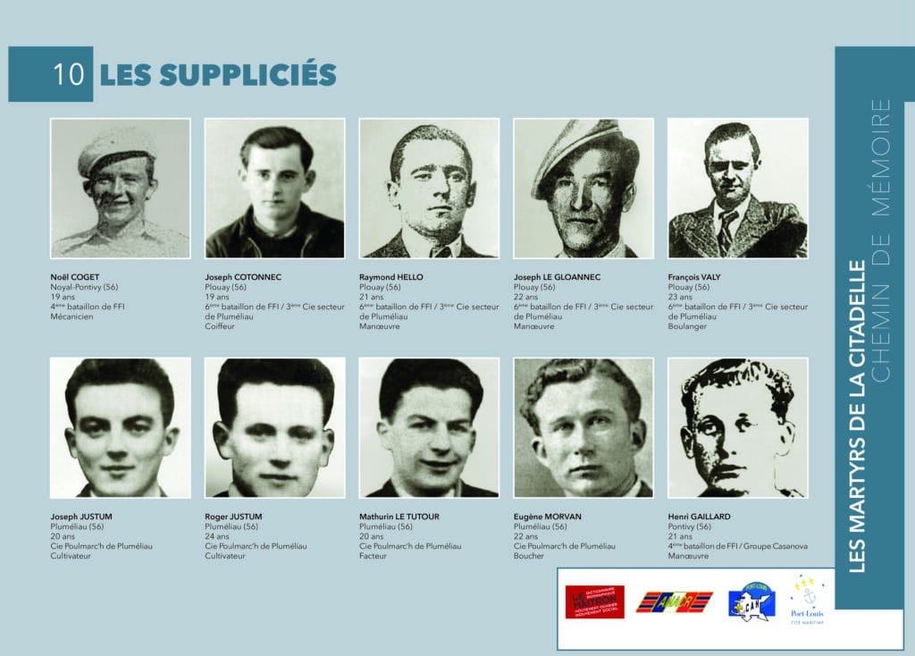
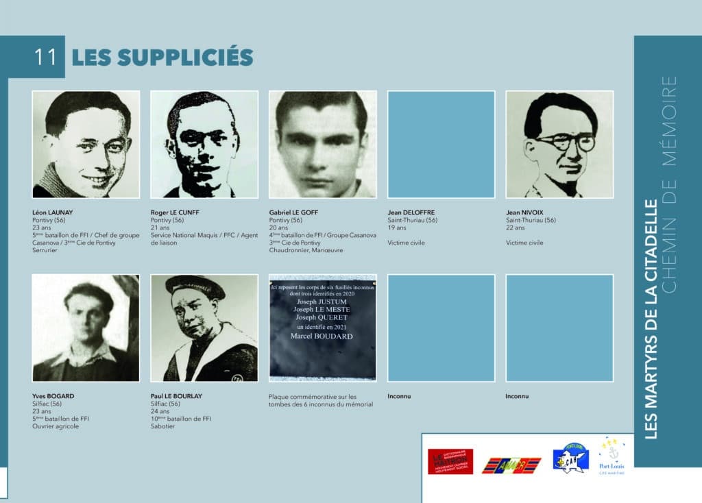
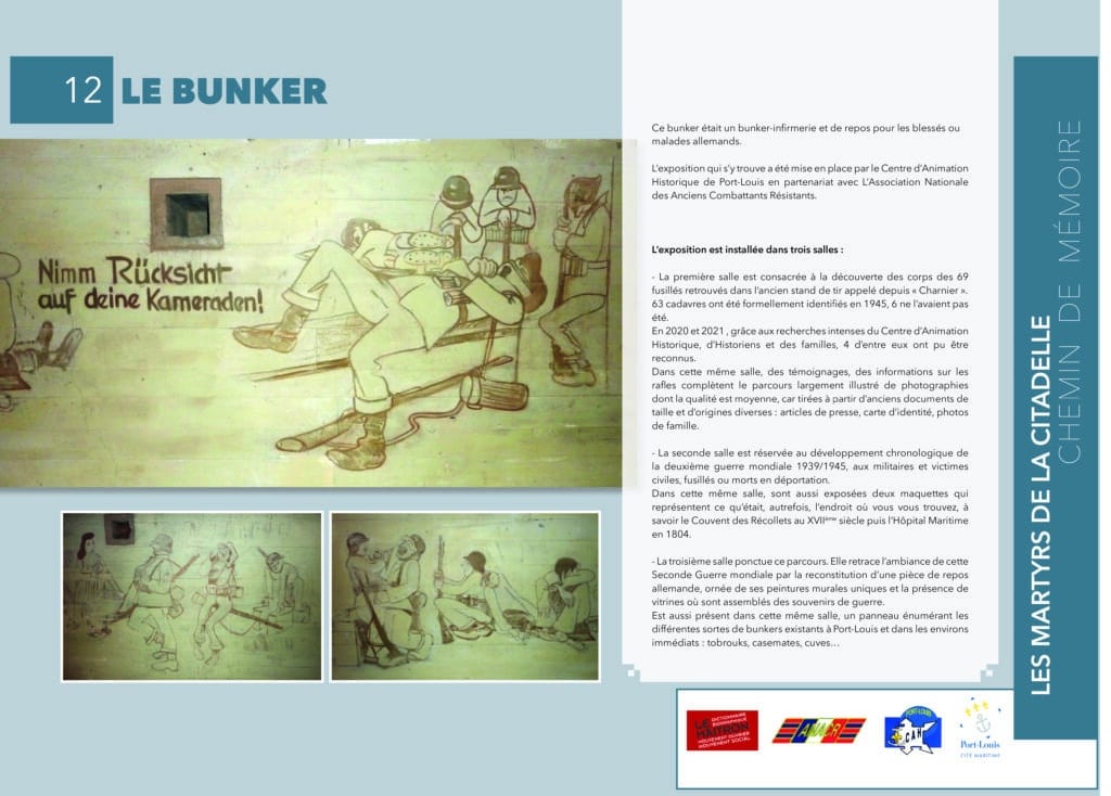
Télécharger le plan du chemin de mémoire
Cette page s’appuie sur les travaux réalisés par le CAH (Centre d’Animation Historique du pays de Port-Louis).
le CAH a l’objectif de faire connaître l’Histoire de Port-Louis, à travers des publications, des expositions, des conférences et des visites guidées de la ville, du cimetière, du bunker de la Radio.
En langue bretonne – Er brezhoneg
Diazezet eo ar bajenn-mañ àr labourioù ar CAH (Centre d’Animation Historique du pays de Port-Louis – Kreizenn Buheziñ Istoerel bro Porzh-Loeiz).
Pal ar CAH eo lakaat d’anavout Istoer Porzh-Loeiz, dre embannadurioù, diskouezadegoù, prezegennoù ha gweladennoù hentet e kêr, er vered hag e bunker ar Radio.
En anglais – In english
This page is based on the work of the CAH (Centre d’Animation Historique du pays de Port-Louis – Port-Louis area historical society).
The aim of the CAH is to make the history of Port-Louis known through publications, exhibitions, talks and guided tours of the town, the cemetery and the Radio bunker.
Textes en breton traduit par mazhev Coviaux, membre du Cercle celtique « An Drouz Vor », et auteur d’une brochure consacrée aux noms de lieux bretons de Port-Louis, éditée par le CAH.